I was invited to join a group of people from my new job to adventure in Zion National Park this past week!
Once I was able to find a dog sitter for Cash, the plan was set in motion. We left Monday, June 30th from Phoenix and headed north. We decided to take my car since it is the biggest, this meant I had to drive that dreaded road to Flagstaff and back again. It went better this time since my car wasn’t fully loaded with all my belongings. We drove for around 6 hours. We passed through Flagstaff, Cameron, and Page. We passed Lake Powell too which was neat. Then we went into Utah! This was my first time actually being in Utah. Our drive time flew by with chats, music, and great views.
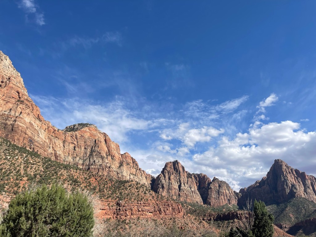
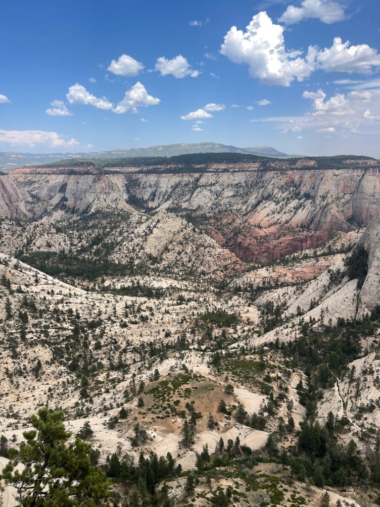
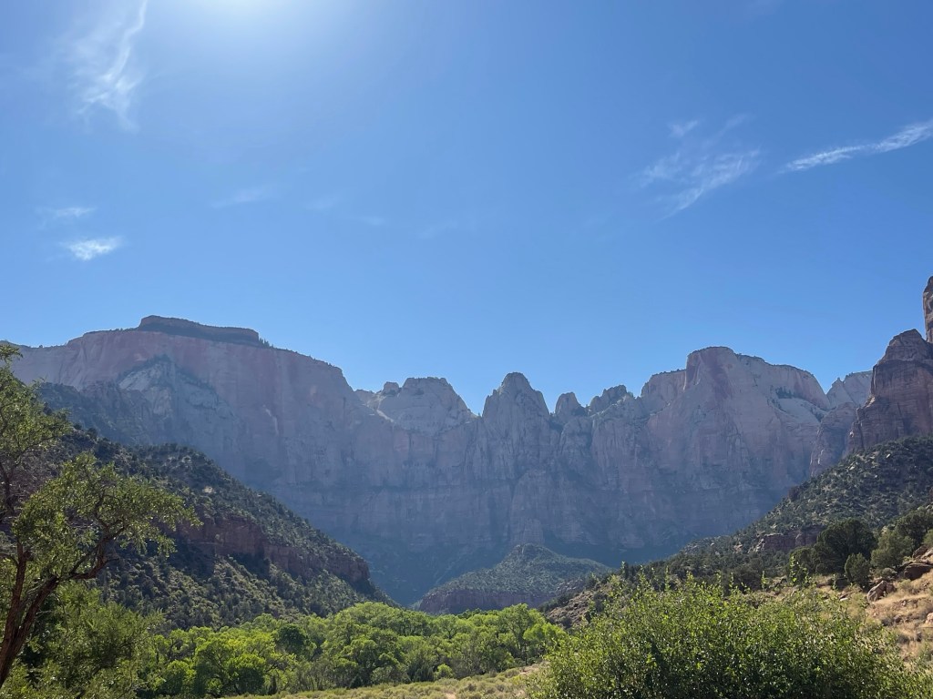
Eventually we made it into the park which was exciting. We could see the canyon open up as we drove farther in, eventually going through a tunnel (!) and then down some switchbacks in the road. The Mt. Carmel tunnel in the park is nearly 100 years old, it opened for use July 4th, 1930 (learned this at the Zion museum!). It was neat to drive through and see the views on the other end. The drive through the park was one of my favorite parts of the trip. The rock walls looked as if they were painted with wide brush strokes. You could see how the rock had been warped and moved over time. Most of the rock in Zion is sedimentary rock, which tells the story of what the environment use to be like there. Looking at the walls are almost like reading a book.
We made it to the visitor center and went inside to obtain a permit for our backcountry campsite. We also got a healthy warning from the ranger on duty. She explained what weather conditions we should expect and the status of water sources. It was going to be pretty toasty, with not a lot of water, and since it is monsoon season there would be some afternoon storms.
We decided to keep on with the established plan, but to be mindful of water and weather. We also had an exit plan just in case things went awry.
After the visitor center we drove through Springdale and headed up the Kolab Terrace Road to the Wildcat Canyon trailhead. after packing our bags we headed out on the trail around 6:00 pm. We had walked about 15 minutes when I questioned whether or not I actually closed the roof box on my car. So on of the guys and I ran back, and sure enough it was wide open. I was so enthralled with getting everything ready to go I forgot to close the box. Thank gosh I remembered!
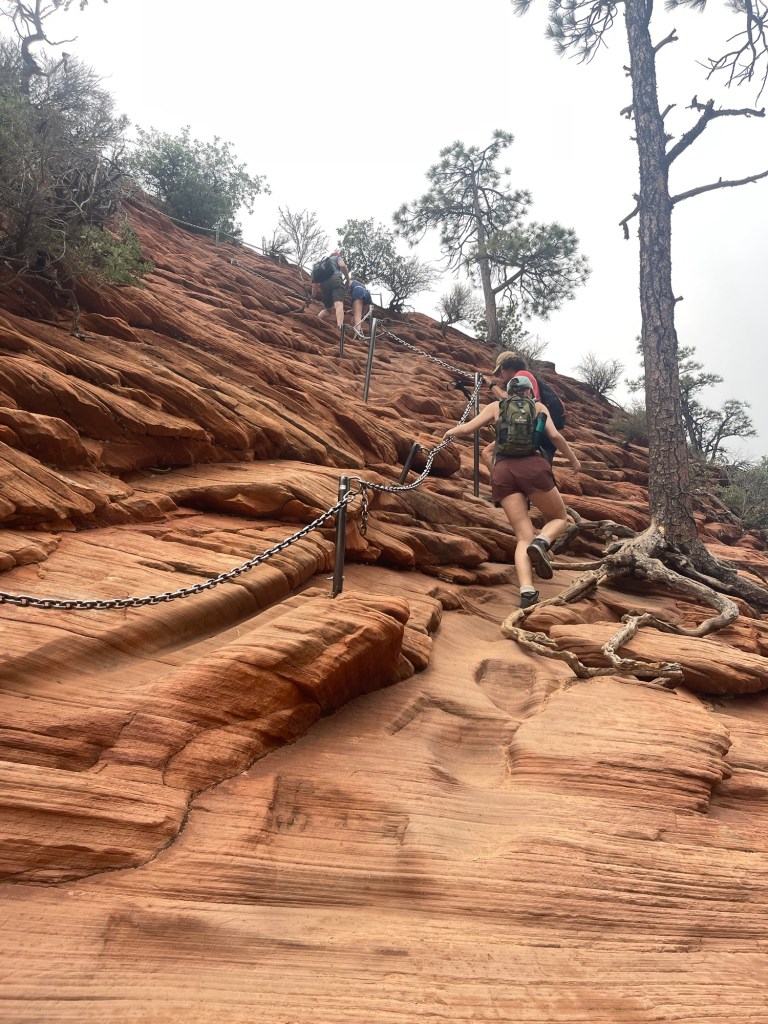
We continued on to our first water source, Wildcat Spring. Here, we filtered a bunch of water and had dinner. There was 4 of us in the group so the trickling water source took a long time to get 4 liters each out of. The views up to this point were mostly of grass, trees, and some views of Wildcat canyon. It was relatively easy walking and very pretty. By the time we left the water source the sun was beginning to set so we all prepped our headlamps. Thankfully we all had headlamps! We walked in the dark for a little more than an hour to get to campsite 9. Thankfully this part of the trail was also cruisey and not too tough in the dark. We passed the time singing and talking. We eventually made it to our campsite, completing around 7 miles of our planned 30 mile trip. the campsite did not have a water source, it was just a big dirt patch. We had enough room for 2 2-person tents, 1 3-person tent, and 1 1-person tent. We all quickly set up our tents and then gathered around to hang out. One of the guys on the trip brought a little guitar so they played that for us. It was relaxing to sit under the stars and hear some music being played.
At some point we decided it was getting chilly, bugs were biting, and it was time to go to bed.
I crawled in my tent, enjoying the view of the stars and curled up to sleep. It was not the best night of sleep for me, since I did not bring my sleeping bag- I thought it would be warm enough for my thick sleeping bag liner. I managed though, it wasn’t too bad. We had some nighttime visitors, some mice that were checking out our smelly food things. Luckily my food was in the bear can, and they didn’t seem to bother anyone else’s things.
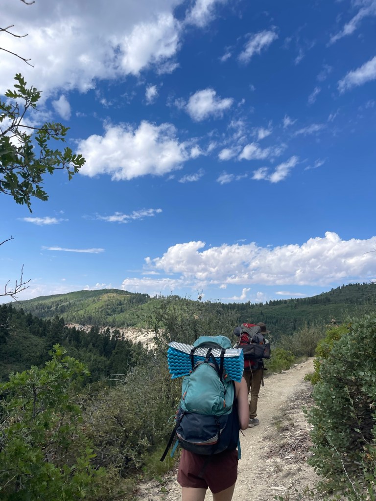
We left camp around 8:30 and started out on what was supposed to be our biggest mileage day. We hiked about 4 miles to campsite 8 where our next water source was suppose to be. Potato hollow spring was believed to have a small pool of water, but it was just mud when we got there at noon. Fortunately we all had water leftover from the spring the day before. But this meant we would have to consider what our next steps were. We knew that the next “expected” source was a 9 mile round trip walk, the afternoon would be hot, and there were thunderstorms in the forecast.
We decided to chill in the shade, have lunch, and weigh our options. These kinds of situations happened a lot when I was on the PCT. We would have to weigh our options, our risk tolerance, and end goals. These happened often on the beginning of the trail with all the snow, and in the Sierras with the thunderstorms. I tried to lead us through a similar discussion, trying to help us make the most educated decision we could. I just hope it wasn’t too intense of a conversation, I just wanted to lead us to a thoughtful group consensus!
Our options were to continue on to this next anticipated water source, conserving the water we have now in case the water isn’t there. Or, to stay put and conserve the water we had for the rest of the afternoon and get water in the morning from Wildcat spring. Eventually we all agreed to continue on to the next source. We left around 1, and it was hot. We had some uphill which was tough in the heat. After our second or third break we decided to split into two groups. Two of the people in the group decided to head back to camp to recuperate and stay hydrated. This meant me and one of the other hikers would continue on, hopefully get water and bring it back to the crew. It was about 3 miles downhill to the water. We exchanged garmin information with the returning group and started off on our separate adventures. The downhill wasn’t too bad. There was quite a bit of overgrown brush we just whacked our way through. As we got closer to the spring we could hear water trickling which put some pep in our step. It was so exciting to get to the spring and have some cold refreshing water. I immediately drank 2 liters of water, so thankful to have water there! Water scarcity scares me more than anything else on a backpacking trip. We sat and enjoyed the views of Zion canyon, took some photos, and filtered around 14 liters of water. From our vantage point we could also see some dark ominous clouds rolling in and thunder clapping. At first I thought the thunder was just some big rock falls, I quickly realized that was not the case. We packed up and kept a brisk pace to try and get back before the weather turned. We made it about halfway when it started to sprinkle. I put my rain jacket on, but we were going uphill about 1400 feet. Which meant, jacket or not I was either going to be soaked with either my own sweat or rain. We made it to our last uphill, took in the expansive views and then booked it to camp. We hiked the last 4 miles in about an hour and a half, both with about 15 pounds of water in our packs.
Back at camp we all celebrated having 20 liters of water collectively by drinking lots! It felt rewarding. One of my favorite parts of backpacking is just having to worry about basic necessities, and how rewarding it is to have to work for water, shelter, and food.
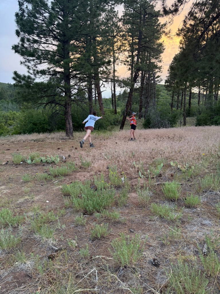
After gorging ourselves with ramen, knorrs, chili, and various snacks two of the people in the group created a game for us all to play. Pine ball. Which, like the name suggests, it is very similar to base ball. We found a large stick and tossed large pine cones to the hitter. If you hit the pine cone you had to sprint around a tree dodging multiple cacti plants, and make it back to “home.” I suck at baseball, so I was not so great at this either. But it was fun to just be goofy in the woods. We also tested the echoes of the canyon we camped near. We shouted various words and phrases to hear them resounding on the canyon walls.
We also dissected one of the dead cacti to see what was on the inside. It looked very similar to an aloe vera plant.
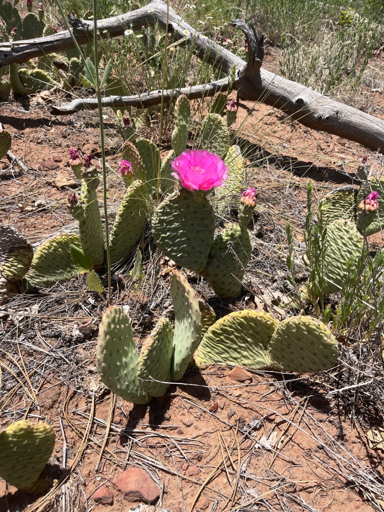
Earlier that day we tried the flower on the prickly pear cactus. I stupidly grabbed the thorned part of the plant. So not only did I have the prickly pear flower, but I also had prickly fingers, prickly legs, and prickly arms.
We went to sleep around 10, and I slept better that night. I was pretty tired from the days events. We had walked around 12 miles that day.
The next morning we left camp around 7:30 am. We had around 11 miles back to the car. The trail was nice and relatively flat with few ups and downs. The views were expansive and we soaked them up as much as possible. We passed a couple of groups too, we hadn’t seen that many people on the trail up until this point. We made it back to Wildcat spring, had some water, snacks and then continued on. We spooked a rattlesnake on the side of the trail which woke us all up. We kept our distance and passed by unscathed.
Our plan was to get back to the trailhead, drive into town, and get ice cream. So that is what we did! We parked and found a nice ice cream shop with hard ice cream. After that we just relaxed on some park benches chatting and talking about plans for the next day. One of the more popular trails in Zion is Angel’s Landing. A pretty difficult trail with great views of the canyon, but requires winning a permit in the lottery. We all decided to enter the lottery to have better odds for our group to win. I didn’t win a shot, but the rest of our group each got in. So we were all set to go the next day before 9 am.
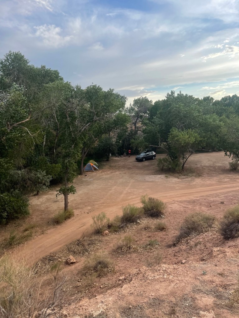
That night we drove to a BLM campsite along the Kolab Terrace Road. There were a couple of people at the site but we still had plenty of room to set up. There was even a little creek to rinse off in. We set up camp, made dinner, checked out the nearby BMX track, and eventually went to bed. I slept amazing that night. I had my full sleeping bag and a little creek to lull me to sleep. I only woke up to my alarm at 5 am, I never even heard another car pull up next to us!
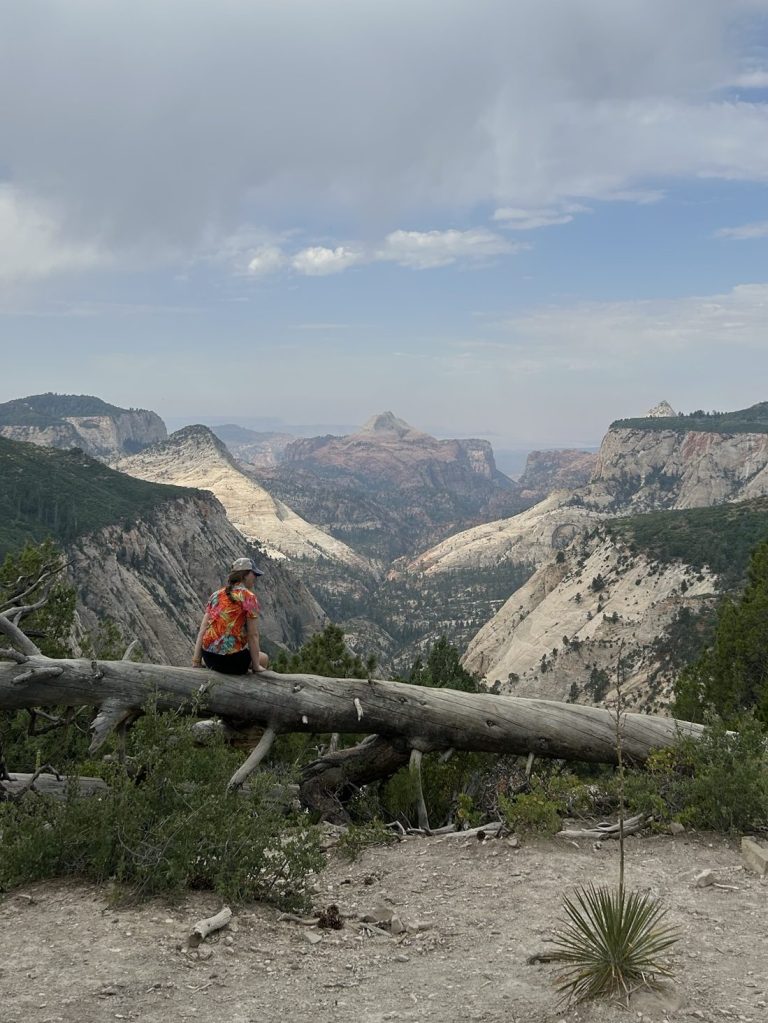
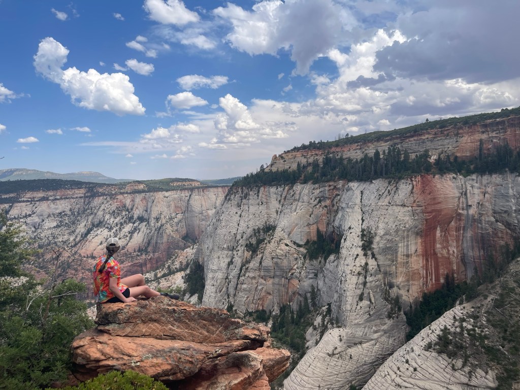
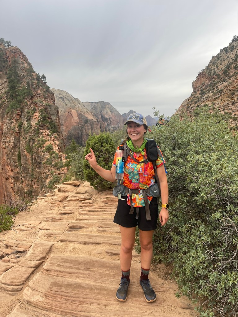
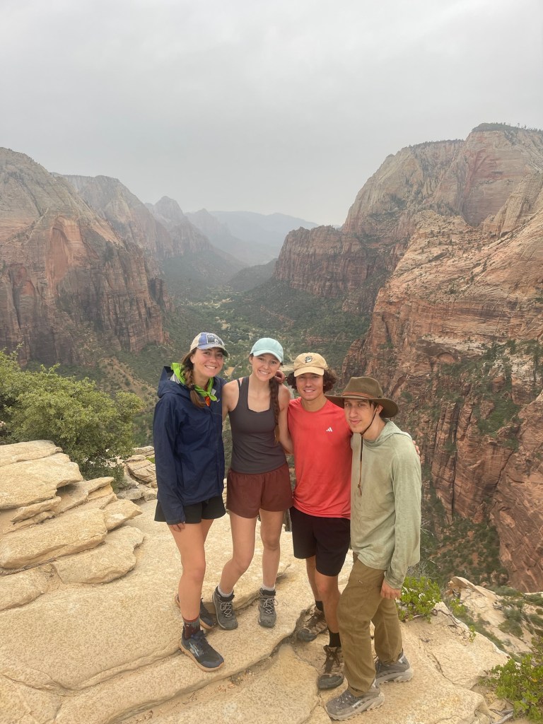
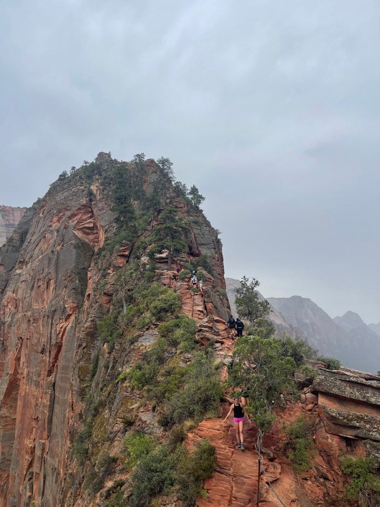
We left the site around 6 am and headed back into the park to take the shuttle to Angels Landing. Even at 6:30 am there was a line for the shuttle. We got on and got to the trailhead, and tried to prepare ourselves for the 5 or so miles that lay ahead of us. There were some intense switchbacks leading us up 900 feet or so. We made it to Scout’s lookout and saw the treacherous part of the trail laid out before us. We would be going up at least a couple hundred feet supported only by chain on one side. My hands sweat just thinking about it. But we went ahead anyway. There were lots of people going up and down the trail and passing people was a bit sketchy since there aren’t many places to pass. I just focused on one step at a time and sang to myself to calm down. After several one steps at a time we made it to the top! You cannot beat the view up there! It was gorgeous, and a bit chilly. We took some photos and decided to head down since it was beginning to rain which would make the trail pretty slick.
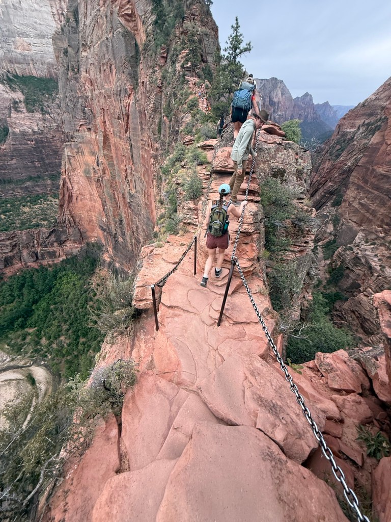
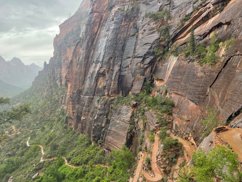
Going down was scarier for me. The chains were really wet and the rock was not super grippy, plus there were lots of people on the trail at this point. We made it to scout’s lookout and then just cruised down the manicured switchbacks.
I was so surprised that there weren’t any rangers checking permits on the way up. The trail was pretty dangerous. In the Adirondacks rangers are out warning people even on bluebird days for some moderate trails, I wonder what they would do if we had an Angel’s landing type trail out there! I guess Zion just trusts that people will make the right decision for themselves.
Once we landed I was hungry and cold, we all decided to head back to the car for lunch and to dry off a bit. I changed my clothes since they were just damp and making me pretty cold. We hung out in the parking lot snacking and chatting, coming up with a game plan for the rest of the day.
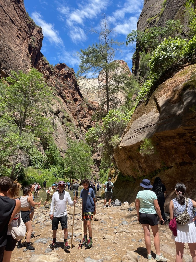
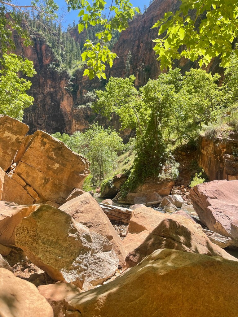
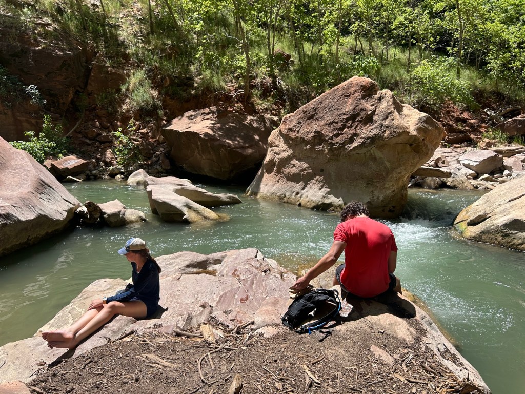
We decided to walk on the river front walk to the Narrows as our last little walk. We all napped in the shuttle ride over there. The river walk was relaxing and had nice views of the river and canyon walls. We walked up to where the Narrows trail begins. There were a lot of people. I did not want to contend with the crowds and being soaking wet for the rest of the afternoon so I decided I wouldn’t continue along on the Narrows. I guess nobody else wanted to either so we settled on finding a private spot of the river to chill at. It was so nice to sit with my feet in the cold water and lay in the sun. Two in our group jumped in and swam around which looked like fun. We stayed there for a couple hours, then headed back to the shuttle. Hanging out by the river was my favorite part of the whole trip. I loved to see the rock walls curving around us, to hear the water rushing combined with echoes of people talking, and to feel the sunshine. It was rejuvenating. I could have stayed there all day.
Afterwards, we headed to the Zion museum. It was nice to learn more about the environment there, and the people who inhabited Zion. The views outside the museum were some of the best in the whole park.
After another shuttle nap we made it back to the car and decided to drive into town for some dinner and ice cream. Both were satisfying after a big day of being out and about.
That night we stayed at the BLM site again. It was pretty windy and there were dark storm clouds surrounding us, but it never ended up raining. We played cards until around 10 pm, and then headed to bed.
The next morning we left camp by 7 am to try and beat any 4th of July crowds. We took a different way back to Phoenix. We drove on this dirt road for a couple of miles that had nice views of Zion and lots of dispersed camping options. We drove through Apple Valley, Fredonia, near Vermillion Cliffs National Monument, Marble Valley, and then continued on south. This was such a beautiful drive. There were lots of dispersed camping options and tons of Forest Service roads. It made me so excited to see all of these options and plan for trips with Conner and Cash. I am hoping Cash and I can explore often while I am here for the next two years. For most of the drive I day dreamed about my hiking and camping goals.
Going back down the Flagstaff road was better this time around, no panic attack! We made it back to Phoenix around 1. I dropped everyone off, we exchanged goodbyes, and then I headed home to see Cashy. He was super excited to see me, and I him. I am hoping that I don’t have to leave him at home for the next adventure, I know he would have liked Zion!
This was a fun trip though and I got to see another one of the National Parks and make some new friends. I am hopeful for more trips like this in the future.

Full map of Zion Wilderness here.


Leave a comment