
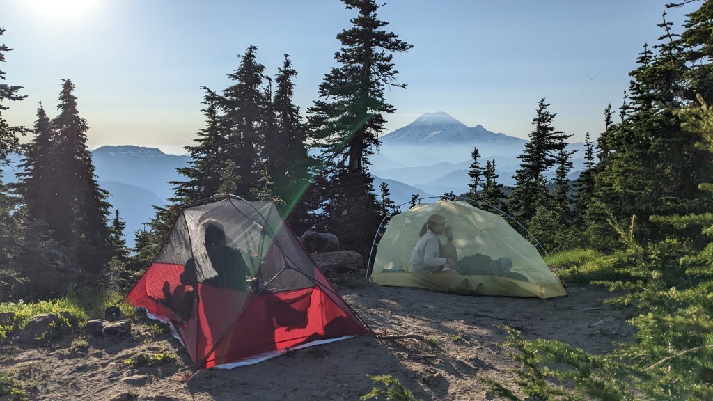
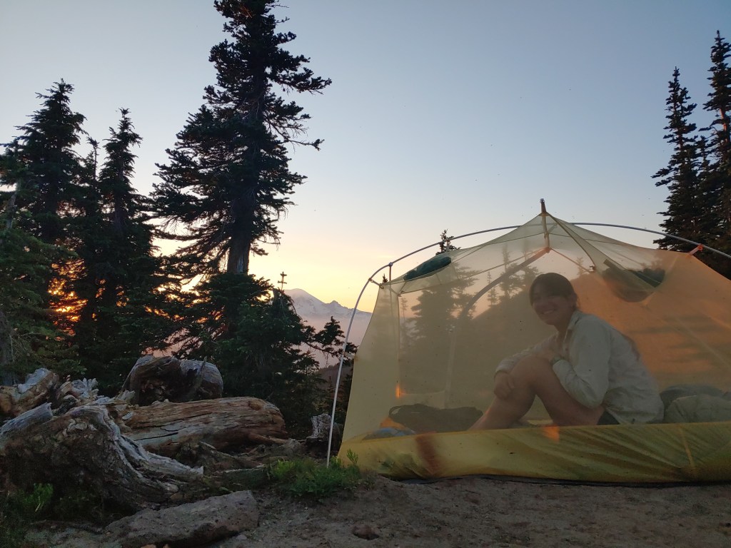
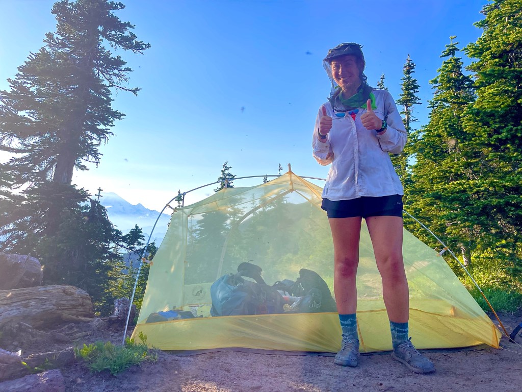
On day 25 we got into White Pass around 8:30 and left by 4. We had time to shower, wash our clothes, resupply, and charge devices. It felt nice to relax a bit before heading on. We decided to go 7 miles up to a viewpoint of Rainier and camp there. It was about 2,000 feet of ascent but we got up there by 6:45. On the way up I heard a familiar voice and turned around to find Ross! We hiked with him from Stehekin to Snoqualmie Pass and then he left earlier from the hostel than we did for the trail. So we haven’t seen him in about 6 days. It was neat to meet up with him again and we camped at the same spot. We enjoyed an amazing sunset with the view of Rainier. I felt so fortunate to have a camp spot where I can see both a great sunrise and sunset. We’ve gotten some news about fires on and around the trail which makes me a bit anxious. I am just reminding myself to enjoy every single part of this trail as much as I can, I’m not going to focus on what I can’t control. I am so lucky to even be out here so I’m just going to take it day by day.

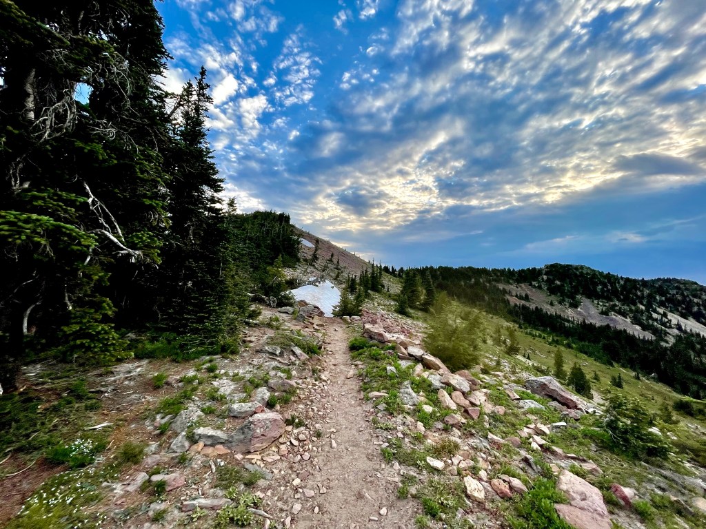
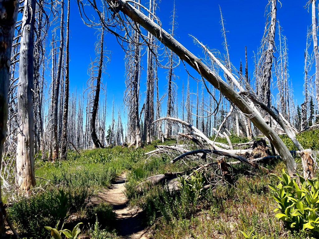
Day 26 was a big day. We enjoyed the sunrise and packed up camp around 6:30. We went down about 1,300 feet in about 5 miles. It felt nice to start the day going downhill for once. We then started the big climb for the day. In 7 miles we went up 2,300 feet. Some parts had little patches of snow which weren’t bad without microspikes. This climb up wasn’t too terrible because we had great views all the way up above tree line. Most of this section was very steep on loose and narrow rocky trail, you can see how steep it goes in the pictures I took. In times like that I just keep my head down and keep walking instead of gasp at how much higher I have to go. At first we got to 6,700 feet elevation and went .2 miles up 200 more feet.
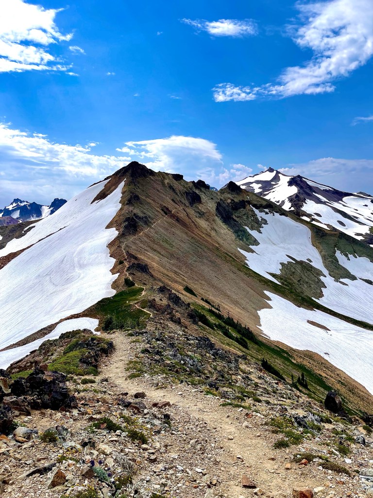
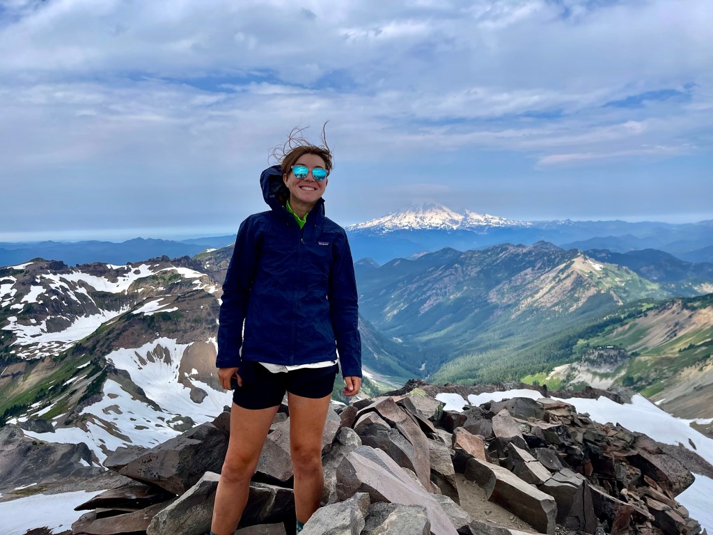
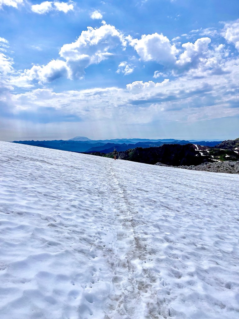
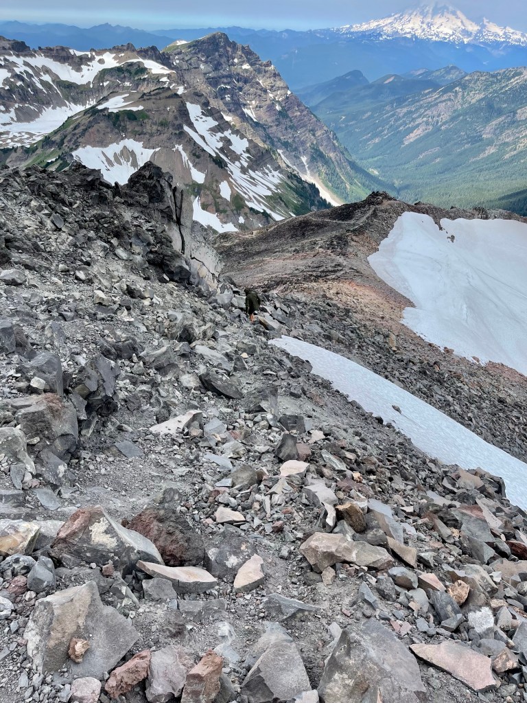
Then it was 6,700 up to 7,100 feet in .5 miles and back down to 6,900 in .2 miles. Then we had another climb before a junction. This climb was 6,700 to 7,200 in about .5 miles. It was a lot of up and down. We got to a trail junction where you can either keep going up the old snowy mountain route or go on the PCT which took a lower traverse over a pass. The pct route was pretty snowy and didn’t look too fun so we decided to just keep climbing up and eventually connect back with the trail on the other side of the pass. We went up about 200 feet more to around 7,500 feet. There was another junction here where we could joint the PCT again or go up and summit Old Snowy Mountain. I can’t resist bagging some peaks along the trail so we kept going up. We left our packs at the junction and went up 200 more feet in .2 miles to the summit which is at 7,742 feet. The rock was super loose but easy to navigate.
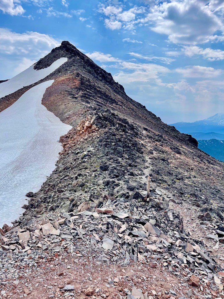
The summit was breathtaking. To my left was Mount Adams, the center was Mount St. Helens, and to my right was Rainier. It was amazing to be up there. That is the tallest mountain I have summited so far. I felt very proud to be up there and it reminded me a lot of when I was trying to finish the ADK 46 High Peaks. I couldn’t stop smiling up there on the summit.
We got back down to our packs and had a well deserved lunch. We sat with our backs to this huge slab of rock which kept us from getting practically blown away. I finished a pack of sour gummy worms which tasted amazing at the time but I soon regretted eating so many when I got a terrible stomach ache down the trail. I also didn’t drink enough water and became very dehydrated.
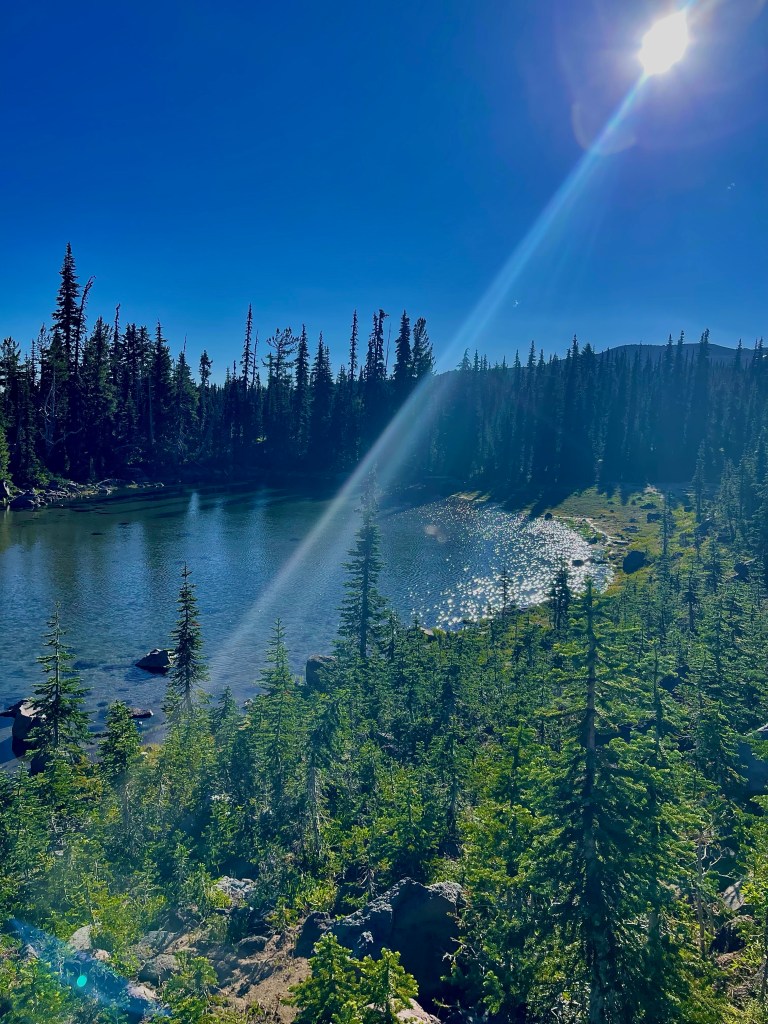
We went down about 2,000 feet and had great views of the meadows and mountains. It was so clear through this portion of trail and had such beautiful scenery. I was pretty tired after all of the up and down so I took a break at a stream and chugged some water. After this I moved pretty slowly to the campsite. We had to go up and over Cispus Pass which was also breathtaking. It was about a 500 foot climb in 2 ish miles but super gradual. You are basically walking around this basin and can see the trail the entire way. We got over the pass and then had 3 miles of downhill to the campsite. These were a hard 3 miles. I felt so wiped from hiking all day and my stomach hurt, so it took a lot to just keep going at a steady pace. Autopilot told me I’d probably feel better if I walked quicker, which worked and my stomach ache went away quickly. We got to the campsite at Walupt Creek at 6:50 and were delighted to find minimal mosquitos. I had Annie’s mac and cheese for dinner and some hot cocoa. I washed up in the stream and then got into my tent. We did 19.5 miles today but around 4,000 feet up and 4,000 feet down. I was happy to just go right to sleep.
Day 27 started off pretty rough for me. I had a huge headache as soon as I woke up. We left camp around 6:30 and decided to go 15 miles to a stream for our lunch break. I was hoping I’d start to feel better as I started walking but it just got worse. I drank a lot of water and had some trail mix which helped a little bit. I did cave in though and took some ibuprofen which really did the trick. I was so tired and dehydrated from the day before so these 15 miles were so slow for me. I just decided to take my time and focus on the trail rather than how I was feeling. From this point on I decided that I am going to make it a habit to stop and drink water every half hour. My water bottles are on the side pockets of my backpack, so I think if I had an easier spot to grab them I wouldn’t forget to drink up. I’ve never been dehydrated before and I never want to experience that again. I felt so achey and almost like I had a fever, which is not a great feeling to have when you have to walk all day.
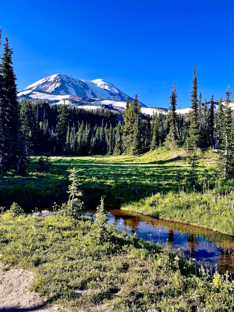
I finally got to the stream around 12:50 and set up my tent to take a nap. It felt so great to lay down and rest, that’s all I wanted to do all morning. I had some lunch and then left the site at 3:30. We decided to go another 9 ish miles to a campsite in a meadow. This way we only had 16 miles to do tomorrow to get into town. The 9 miles were pretty slow since we went up 1,800 feet and we were both very tired. It was a great stretch of trail though, it wasn’t too steep and it was very sandy so it was almost like a cushion to my feet. I listened to some podcasts to take my mind off of how exhausted I was. We made it to the site around 7:30 and I was relieved to say the least. We had a great view of Mount Adams and a waterfall nearby. It was a little windy too which kept the mosquitos away! The meadow was so beautiful and watching the sun set over Mount Adams was kind of magical. I washed up in the waterfall which helped me feel a bit better after a long day.
I’m happy we have had two great campsites in this section with views of the nearby mountains. I had some knorrs fettuccini Alfredo (a real treat) for dinner and a snickers bar for dessert. In total we did 24.3 miles on this day.
On day 27 we slept in! I felt rejuvenated and ready to hike to town. I woke up at 5:30 and looked at my watch and was excited that I could sleep in for another hour. I made some coffee and enjoyed the view of Mount Adams. We left camp by 7:45 and walked 15 miles to the road that takes us to Trout Lake. It was a little up and down for the first 8 miles and then down for the remaining. I saw lots of hikers coming from town. But turns out there aren’t many John Prine listeners on the trail. People pass by and ask how I am and I say “pretty good, not bad” and no one ever replies with “can’t complain!”
We got to go the road by 1:30 and waited around for the shuttle to come. There wasn’t much traffic on this road either. A couple nobos came through and waited with us. I met my first New Yorker on the trail too! it was kind of neat to finally meet another New Yorker.
There is a group of guys that run a hiker shuttle service and we got picked up by 4. We got to Trout Lake and set up camp behind the general store. This town is super hiker friendly, they’ve got charging stations, free laundry, free towels and soap, and free camping! Everyone is super friendly so I don’t mind taking some time to rest here. We have about 80 miles left in Washington. In total we have now walked 454.3 miles. This section of the trail was a big worry of mine because of the reports of snow. I sent my snow gear home back in Snoqualmie Pass and was concerned that I would need it here. Luckily I didn’t and my nightmares were put to rest after getting through Knifes edge.
Also, I will not be buying sour gummy worms for this next section, I think I’ve had my fill for a while.


Leave a reply to Anne Varno Cancel reply