Mount Colden is one of the 46 High Peaks located near Lake Placid, New York. It is the 11th tallest high peak!
I was suppose to hike Mount Colden last July but wasn’t able to since I ran out of time. So I saved it for one of my last high peaks and decided to tag it on to my last hiking adventure in the Adirondacks. When I went hiking there was a huge thunderstorm warning for Northern New York. It rained the entire time I hiked and at the top of Colden my thermometer said it was 30 degrees Fahrenheit not including the chill from strong winds. Needless to say it was not ideal hiking weather, but I was pretty determined to finish off the 46 High Peaks.
I started at 6:20 am on June 18, 2022. There are a couple different routes to take you to Mount Colden but I chose to take the Van Hoevenberg Trail most of the way. I parked at the Adirondack Loj and at 6 am there were still plenty of parking spots. It cost me $15 to park here for the day, but prices may vary. More information about parking at the Loj can be found here.
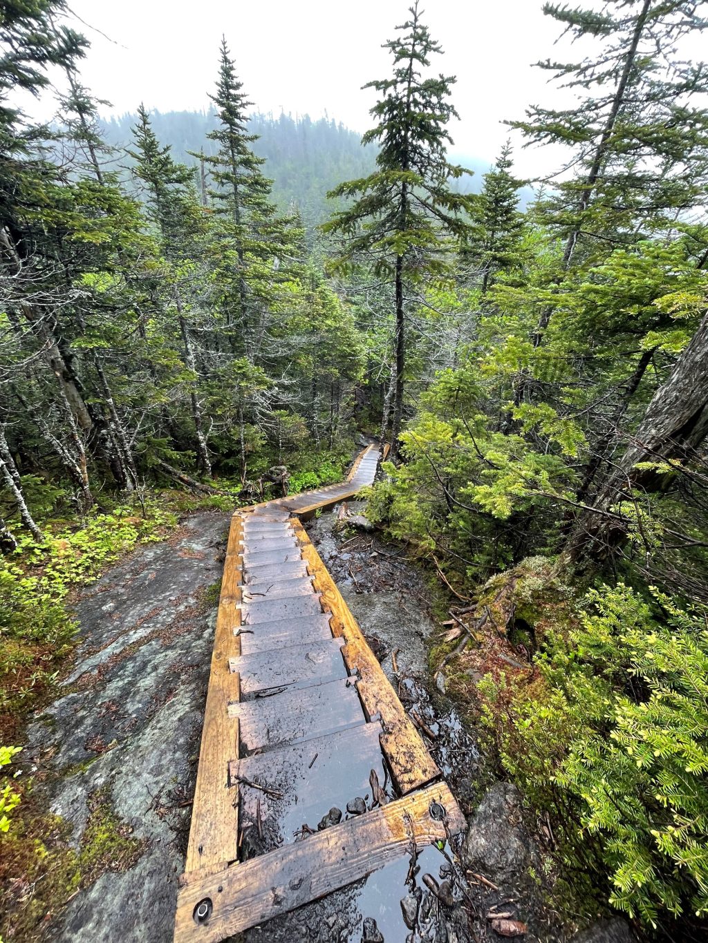
I started the trail by signing into the trail register right next to parking lot 1. I followed the Van Hoevenberg Trail all the way to Marcy Dam which is about 2.5 miles away from the parking lot. Marcy Dam has a bunch of campsites, lean-tos, and opportunities to replenish your water supply. As you approach Marcy Dam take the trail that goes to the left and it will have you cross a bridge. After crossing this bridge continue to the right on the trail and pass by the Marcy Dam trail register. At this point the trail will connect with the Avalanche Pass Trail and you will follow this for about a mile and then going to the left onto the Lake Arnold Trail. On the Avalanche Pass trail during this hike, you will not get the scenic views from Avalanche Lake. However there is a way for you to hike the entirety of the Avalanche Pass Trail and summit Mount Colden. I chose not to because that trail adds about 2 extra miles.
The Lake Arnold Trail has a bunch of tiny little boulders and follows a stream most of the way up. It isn’t terribly steep it just hurts your ankles when you go downhill on this trail. The Lake Arnold Trail will take you to the Morgan Porter Trail which ultimately takes you to the summit. At Lake Arnold you are at mile 5.7 and at 3,700 feet in elevation. Mount Colden is about a mile away from this point and up 1,000 more feet. The trail isn’t too bad in my opinion. You go over a false summit and get a view of the top of Mount Colden which is pretty cool. At the false summit you have to go down a couple hundred feet and back up. At this point in the trail there are stairs/steps set up so that the climbing isn’t too dangerous. I do not remember any challenging parts on this trail where I had to use my hands and feet.
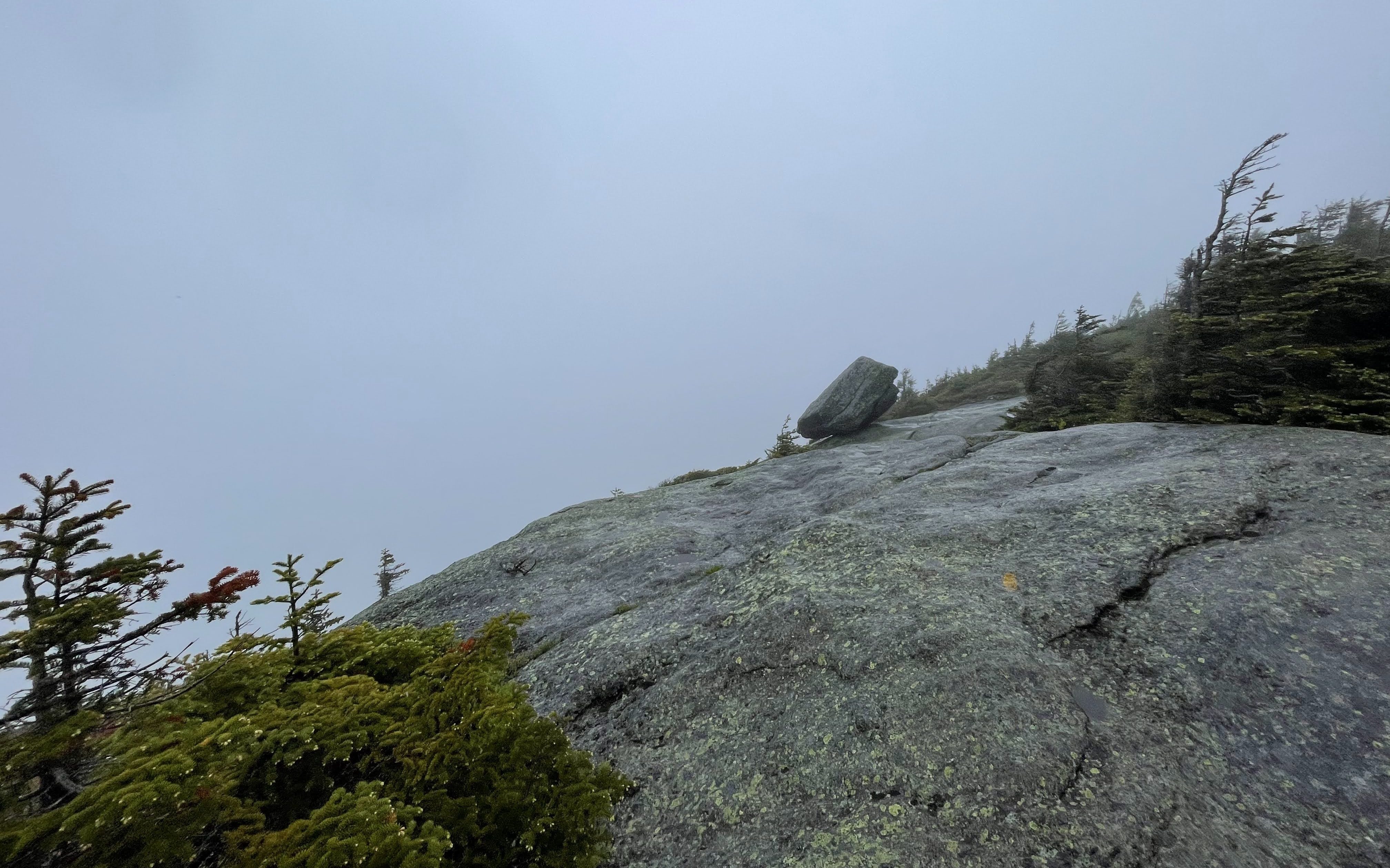
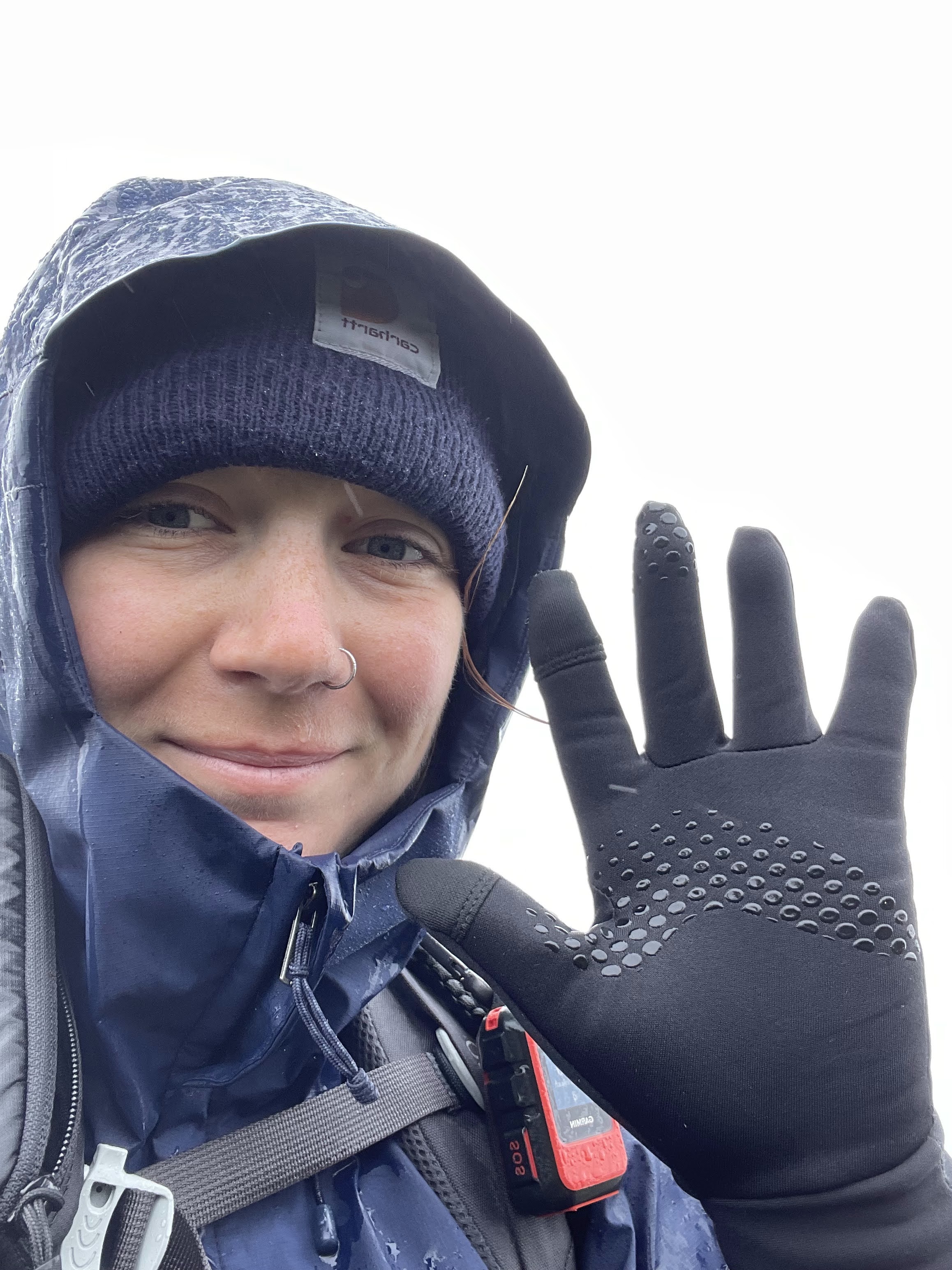
Near the summit you will walk over some exposed sections of trail and then eventually reach the top. I just followed the herd path at this point. I got to the top at 9:50 am. The summit was completely socked in so there were no views. I had gloves, my racing jacket, a beanie, and pants on at the top because it was so cold. I took a couple pictures and made my way back down because I did not want to risk getting any colder. Remember that even in June there are still sometimes winter/spring conditions in the high peaks. I saw a bunch of people on my way down who were headed to Colden. One person was wearing shorts and t-shirt. I am not sure if they had more layers in their pack but I did warn them that the summit was cold and super windy because I was worried that they could get in some serious trouble if they thought it was going to be a sunny summit. So, always bring layers when you hike so you don’t potentially end up like that hiker.
To get back to the parking lot follow the exact trail you took on the way in. I got back to my car around 1 pm.
Overall thoughts on the trail
The entire trail is about 12 miles long with steady elevation gain and easy to navigate terrain. I found it to be one of the easier high peaks I have done.
If you choose to do this hike I would pick a day when the weather is nice so you can enjoy the views on the semi exposed summit. It seems to be a pretty hike when it is nice out. If you go when the weather is poor just be extra careful on the ladders/steps because they get pretty slick in the rain.
As I have mentioned before, always bring extra layers when you go hiking. I stayed pretty dry with my rain jacket and was happy to throw on the fleece I kept in my bag halfway through the hike to keep warm. I was glad to have my gloves as well, even though they were soaked at the end of the hike. I have seen some people wear latex gloves over their cloth gloves to keep them warm. I am not sure how well this works but I guess that is an idea if your hands get cold easily.
If you are starting your 46er journey this is not a bad hike to start with! There isn’t much elevation gain and it’s low mileage so I definitely manageable for a beginner.
What I brought
I am getting ready to thru hike the Pacific Crest Trail so I brought my fully packed backpack to prepare. I will not list all of that here since you obviously don’t need it all.
- 50 L back pack and rain cover
- 32 oz Nalgene with hydration mix
- 2 32 oz plastic water bottles
- Beanie
- Rain jacket
- Fleece
- T-shirt
- Hiking pants
- Trail runners
- Wool hiking socks
- Trekking poles
- First aid kit
- Gloves
- Sawyer squeeze
- Food!
- Peanut butter sandwich
- Cliff bar
- Apple
- Fruit roll up

Leave a comment