Gray Peak, Mount Redfield and Cliff Mountain are three of the 46 Adirondack High Peaks. This hike, according to my AllTrails app and Strava was around 30 miles long which took me 18 hours. This is obviously longer than any hike I have ever been on, and I will get into why it was so long later on in this post. This post is also going to be a bit longer than usual.
I started this hike on July 21, 2021 at 6:50 a.m. and finished at 1 a.m. The next morning. the trail starts from the Adirondak Loj, which is a popular campground and central to a lot of trails in the High Peaks. Parking here costs $10 or more last I checked, it varies with group size and how many days you will be parked. This parking lot also fills up quickly on the weekends/summertime so I advise getting there early or hiking on weekdays. I was able to secure a parking spot since I was early and hiking on a Wednesday.
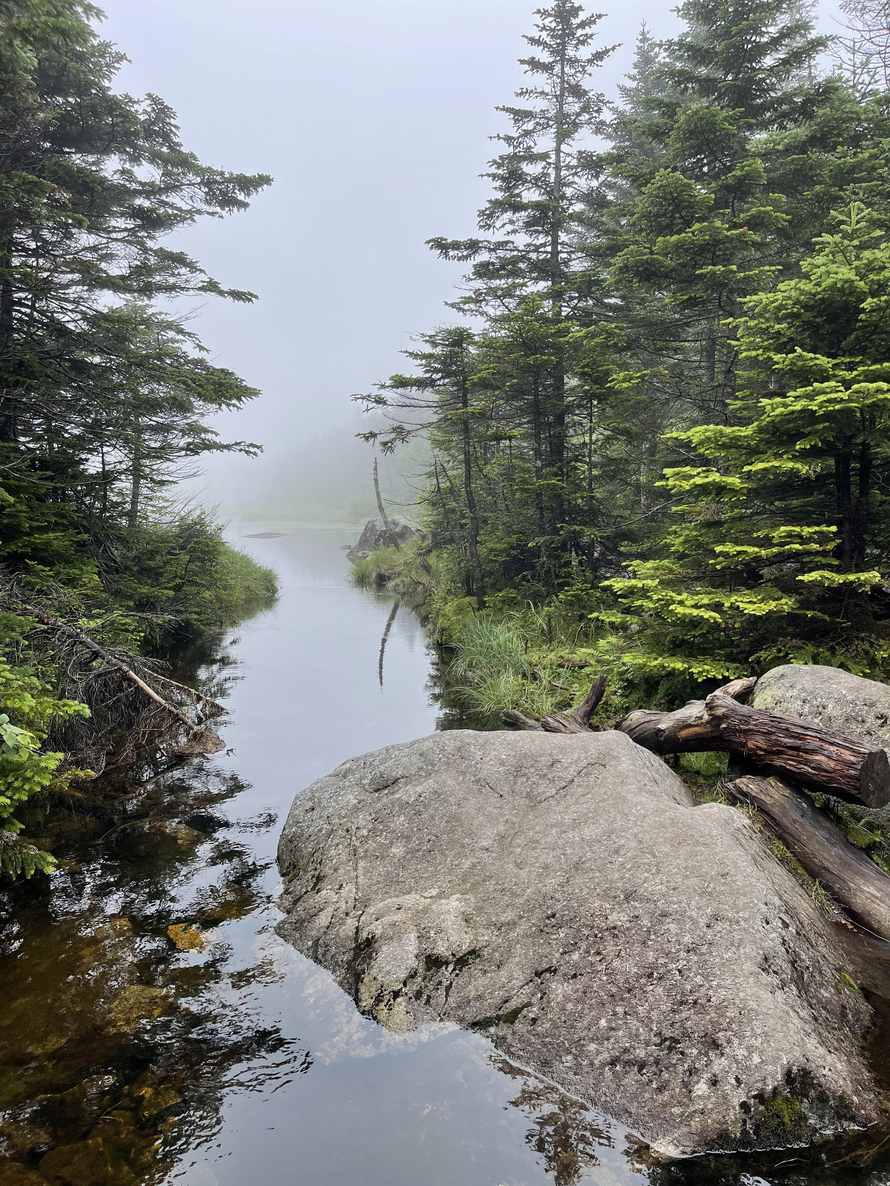
I started on the Van Hoevenberg Trail and followed this trail for about 3 miles until reaching Marcy Dam. This beginning section is a nice warmup for any of the trails you take off of the Van Hoevenberg Trail. It isn’t too much elevation gain and the woods are interesting to look at. Marcy Dam is a good spot to take pictures and refuel before embarking onto a new trail. There are also a lot of campsites and lean-tos around the dam, and you can find more information on them here. If you take a different trail from Marcy Dam make sure that you sign into the trail register just to be on the safe side.
From Marcy Dam i took the Avalanche Pass Trail. I followed this trail for about a mile before switching onto the Lake Arnold Trail. At this point in the trail you have gained about 2,000 feet in elevation.
The Lake Arnold Trail was muddy when I passed through, and was worse than the bog I encountered on my hike in the Santanoni Range. I luckily had trekking poles with me which made navigating the mud a lot easier. I used the poles to check the depth of the mud and to locate any floating logs. This didn’t completely protect me from getting muddy though, one of my boots almost got plucked straight off of my foot. This trail was one of the least enjoyable parts of this hike, but luckily I only had to pass through it once. Try going on this trail when there has not been much rain, and it shouldn’t be as muddy.
From the Lake Arnold Trail you will take the Mount Marcy Trail. This switch is at the 7ish mile mark. you will follow this trail for about 1.5 miles before taking the Gray Peak trail. This trail isn’t that bad, you gain about 1,500 feet in elevation gain from the switch onto the Mount Marcy Trail. The summit of Gray Peak is wooded so there is not much there for views. I got to the top at 12 p.m. the summit of this mountain made me proud because it is the peak that I had to miss the first time I ever went hiking. Normally people hike Gray, Marcy, and Skylight together. It felt great to make it up there, especially since I did it alone. I stayed up there long enough to have a quick snack and take some pictures since I knew I had at least two other mountains to hike that day.
From the summit I made my way back down to the Mount Marcy Trail. I also stopped to take some pictures of Lake Tear of the Clouds. This lake is the highest water source that feeds the Hudson River.
At the trail junction I stayed on the Mount Marcy Trail that goes in the opposite direction. At around the 11 mile mark you come to another trail junction and take the Mount Redfield Trail. You will stay on the trail that goes to the left which will take you to the summit of Mount Redfield. In about a mile and 1,200 feet in elevation gain you will be at the top of Mount Redfield. This trail was difficult though. It was raining all day, so the trail was extremely wet and muddy because you are essentially following a stream all the way to the top. So, I was completely soaked by the time I got to the top. The trail is also not marked and not maintained so it can be difficult to follow in certain spots, make sure to follow the rock cairns that other hikers have set up. The summit wasn’t much to write home about since it is wooded, and was cloudy the day I went. It was almost 4 p.m. when I finally reached the top. I was pretty careful on the descent too since the trail was so slick. I also sang out loud to myself on the way down just to stay somewhat entertained, and because I thought no one else was around. I was wrong, and probably really frightened a young girl that passed me on her way up.
At the trail junction I took the Cliff Mountain Trail, which is also not marked or maintained. You only gain about 500 feet in elevation from the trail junction to Summit. This is a trail I would highly advise against doing alone or as a beginner. It wasn’t too bad until I came to the giant rocks in the middle of the trail. There is a huge rock that does not have any real alternate routes around it. So, you just have to try and climb up it. This was the scariest part of trail I have ever been on because I thought for sure I would hurt myself or have to turn around. I somehow made it up the rock by climbing up with my hands and feet, so unfortunately I don’t have much advice for this section besides taking your time to figure out your own path.
The trail to Cliff is scenic since it has such open rock faces so enjoy the views on the way up because the summit doesn’t offer much. I got to the top pretty late, at 6:40 p.m. I took some pictures ate a quick snack and packed up to go back down. Going down was tough because of how steep and difficult sections of the trail was but I just took my time and tried to navigate safely which I advise others to do as well.
When I was at the end of that trail a group of hikers asked me where I was camping that night and when I said I was going back to my car they gave me a surprised look. That was my first clue that I may have bitten off more than I can chew for this hike.
From the trail junction at the base of Cliff I took the Mount Marcy Trail (not the same portion of the trail i was on earlier). At this point I told myself that if I made it to the base of the trail to Mount Colden, then I would go to the top and head back to my car. However that trail was about 5 miles away from the top of Cliff, so I was not able to make that hike, which was honestly a bit too ambitious for me in the first place. I turned onto the Avalanche Pass Trail and hiked along Lake Colden. This is one of the most scenic trails in the Adirondacks and I was hiking it in the pouring rain at 10 p.m. Despite this it was still enjoyable. I didn’t get to experience the beauty of this trail in the sunlight, but I could still see the surrounding mountains looming over the lake and the stars and moon shining on the water. It was beautiful all the same. The Avalanche Pass Trail was amazing because there are sections of the trail that are bridges that bring you above the lake and inches from the side of the mountain. It was a lot of up and down but nothing that isn’t doable.
I followed Avalanche Pass all the way back to Marcy Dam which is where I went back onto the Van Hoevenberg Trail, the same one I took on the way in. this hike back was long. At the beginning of the Avalanche Pass Trail I was still 10 miles away from my car. At Marcy Dam I was 5 miles away. At this point I picked up the pace since it can be pretty dangerous to be in the woods that late at night, especially with the high bear activity reported. I just clicked my hiking poles together so if there were any animals, they’d hear me before they’d see me. The rest of the way was just quick and rainy. I started my car at 1:05 a.m. and drove to my campsite.
overall thoughts on the trail
This was the longest and most dangerous hike I have ever been on. If anyone is planning to use this route break the hike into two or even three days and then you’d be able to enjoy all of the trail and tick 4 high peaks off the list. There are plenty of campsites and lean-tos along the trail to camp at.
This trail was dangerous because I underestimated the trail and mileage. So, this is just an example of why it is important to be prepared before heading out into the backcountry, research the trail and map out the mileage. Be prepared for anything you might encounter out there. Luckily I had anything I would need to make an emergency camp if need be in my pack, and didn’t have to use it, so just another example that its better to be safe than sorry. It was a little scary to be hiking that late worrying about bears and then seeing signs posted that there has been high bear activity and the number one thing to avoid is hiking past dark.
Since Cliff is just such a beast please try to go with a group or another person to at least have some help and support on that trail.
what I brought
- 50 L hiking pack
- Merrell Moab 2 Mid-ventilator women’s hiking boots
- rain jacket
- hiking pants
- long sleeve shirt
- hiking socks (2 pairs)
- bandana
- trekking poles
- first aid kit/emergency kit
- extra sweater
- 2 L bladder bag
- nalgene water bottle with hydration mix
- Food!
- peanut butter and jelly sandwich
- trail mix
- apple
- 2 cliff bars
- mom’s homemade hiker bars
- gatorade energy chews
- tortilla chips

Leave a reply to Anne Varno Cancel reply