
I get asked a lot about the best hikes for beginners to do, so I figured, why not make a post about it?
I love hiking in the Adirondacks and I want to make sure they are accessible to other people. So this post will be a ranked list of beginner hikes in the Adirondacks from easy to more difficult (ones that I have personally been on) and what to expect on those trails. I hope this helps out anyone thinking about starting to hike and let me know what questions I can answer.
- Mount Arab
- Mount Goodman
- Bald Mountain
- Mount Baker
- Haystack Mountain
- St. Regis
- Cascade and Porter
- Ampersand
- Street and Nye
- Giant and Rocky Peak Ridge
Mount Arab
Mount Arab is 2 miles with 750 feet of elevation gain. The trailhead has room for several cars but will fill up quickly on the weekends with nice weather.
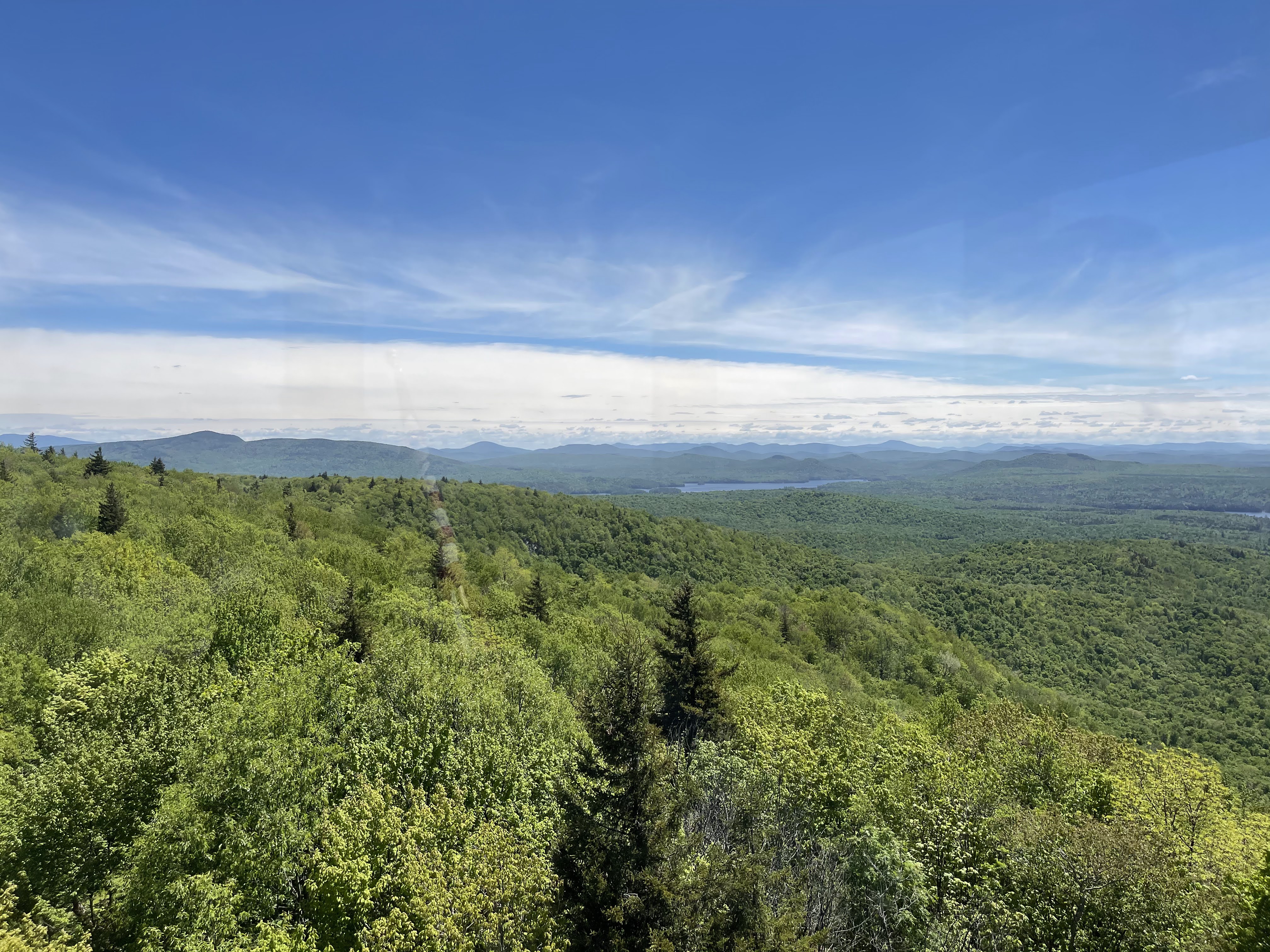
From my experience the trail has been well marked and easy to follow. It is a relatively moderate grade and will be steepest near the very top. At the top there is a nice fire tower that will give you 360 views of the Adirondack region. There is also a cabin at the top, and sometimes will be open in the summer to provide information about the wilderness on Arab Mountain. To make the hike even better, it is part of the Tupper Lake Triad which is a fun challenge to encourage you to get out hiking more! Here is a link to the trail on AllTrails https://www.alltrails.com/trail/us/new-york/mount-arab-trail?u=i&sh=blois0.
Mount Goodman
Mount Goodman is a step up in difficulty from Mount Arab just because it is a mile longer. It’s 3 miles with about 500 feet of elevation gain. Even better, the first .3 miles of the trail is a paved pathway! So you don’t need to worry too much about those branches and rocks on the trail tripping you up, the ENTIRE time. After that paved section it does get a bit steeper in the moderately steep category (8% or less grade). The parking lot is still a good size at the trailhead, but less space than Mount Arab’s parking lot.
The trail is well marked and easy to follow, another reason why it’s a great beginner hikers choice. It is also part of the Tupper Lake Triad. I enjoyed this hike and it took me about 1.5 hours. Here is a link to the trail on Alltrails. https://www.alltrails.com/trail/us/new-york/goodman-mountain-trail?u=i&sh=blois0
Bald Mountain
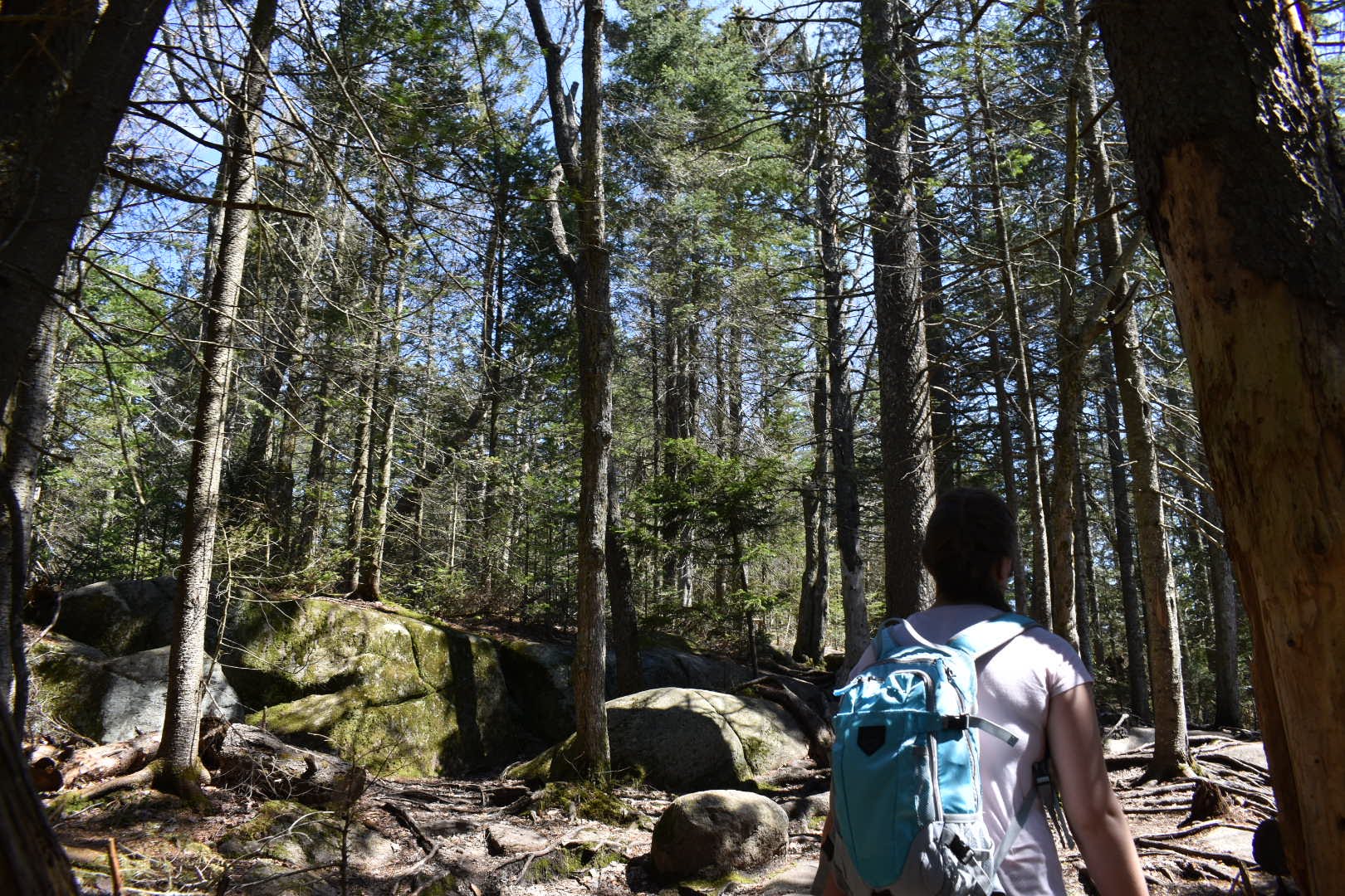
I hiked Bald Mountain during the beginning of the pandemic and it was only my third or fourth time hiking. I found the trail to be relatively easy with rewarding views on top. It is part of the Fire tower challenge as well. The trail is about 1.8 miles with 410 feet of elevation gain. The beginning of the trail is a leisurely walk through the woods with the steepest section near the top where you follow along a couple ups and downs. Trail markers lead the way, but be careful, since it is such a popular trail there are several herd paths on the mountain. I’d highly recommend this trail for mud season since it sits at a lower elevation than the ADK High Peaks. Bald Mountain tops out at 2,313 feet and has nice views of surrounding lakes.
If you are worried about hiking alone or hiking in general this trail is very popular so you will almost always be hiking with others on a nice warm weekend. Here is a link to the trail on AllTrails. https://www.alltrails.com/trail/us/new-york/bald-mountain-rondaxe-fire-tower?u=i&sh=blois0
Mount Baker
Mount Baker is part of the Saranac Lake 6 and is a pretty fun hike. In order for it to count toward the Saranac Lake 6 challenge you need to walk from the Berkeley Village Green. The extra half a mile is to your advantage though because parking is limited at the trailhead. Walking from the village green you walk past Moody pond which can be nice in the cooler months when black flies aren’t out. The entire trail is 2.6 ish miles with 885 feet of elevation gain.
The trail is well marked and since it is popular there are several herd paths on the mountain. You start out with a gradual incline that remains steady all the way to the summit. This is another great hike for kids or dogs since there aren’t any rock scrambles! Baker Mountain tops out at 2,441 feet. Here is the trail on AllTrails. https://www.alltrails.com/trail/us/new-york/baker-mountain?u=i&sh=blois0
Haystack Mountain
Haystack Mountain is a bit longer than the previous mountains but still appropriate for a beginner to intermediate hiker. The trail is about 5.7 miles with 1,007 feet of elevation gain. This is a longer and steeper hike so please plan accordingly. This could mean maybe training more outside the trails to prep for hiking.
The Jackrabbit trail will take you most of the way to the summit, about 2.5 miles. The North Haystack trail will take you to the summit but sometimes it can be easy to miss. It will be on your left and sometimes hikers mark the spot with rock cairns, so keep an eye out.
The Jackrabbit trail is well marked and easy to follow. Be advised that it is a cross country ski trail so in the winter it is only open to skis and snowshoes during that time.
The trail can be done with Mackenzie mountain too if you wanted to knock out to of the Saranac Lake 6.
On the Jackrabbit trail there is a lean-to you can stay in. I camped there with my dog, Cash, last year and it was chilly! It was neat though to have a short hike and camp. There is not a lot of room for parking at the trailhead so get there early! Here is the trail link. https://www.alltrails.com/trail/us/new-york/haystack-mountain-via-jackrabbit-trail?u=i&sh=blois0
St. Regis Mountain
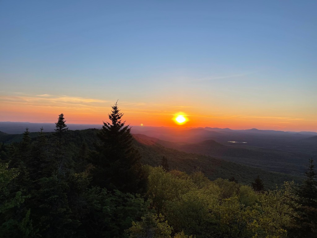
Honestly most of the mountains in the Saranac Lake 6 challenge are great introductory hikes. St. Regis is one of them! This is also one of my favorite hikes since it is moderately challenging with rewarding views, especially if you are equipped to go at sunset.
St. Regis is a step up from Haystack. It’s about 7 miles with 1,600 feet of elevation gain. There are a couple small rock scrambles. Personally I like the rock scrambles, it breaks up the monotony of walking on a trail. But, if you are just getting into hiking in the Adirondacks, maybe bring a friend for some support during those rocky sections. The trail maintains a steady climb for 2 miles and then gets steeper the closer you get to the top. Since this is a steeper hike I would recommend bringing hiking poles with you to maintain balance and comfort for your knees. The trail is well marked. I would also recommend training to work up to this hike, especially if you are new to it all!
The summit sits at 2,850 feet with great views of Saranac Lake, especially from the fire tower. Here is the trail on AllTrails. https://www.alltrails.com/trail/us/new-york/saint-regis-mountain-trail?u=i&sh=blois0
Cascade and Porter

Now we get into the High Peaks! Although Cascade and Porter are a shorter hike, they are still a bit more challenging than St. Regis because of the grade of the trail. The trail is about 5.5 miles with 2,200 feet of elevation gain.
This is probably the most popular High Peaks hiking trail. Parking will fill up quickly by 7 am on a nice weekend. You will see cars lined up and down Route 73 for this hike. That being said, you are almost never alone on this trail if you go during peak hiking times.
Another note about the trail, AllTrails states there is a “restroom” near the summit. This does not mean there is a flushing toilet and sink to wash your hands. It is just a seat and hole in the ground to do your business. Since this trail is so popular practice Leave No Trace! Go to the bathroom at the port-a-potties at the trailhead or at the seat near the top. The vegetation on Cascade is extremely fragile so don’t walk or let your dog walk on it. I would not recommend this trail for mud season, it is a mess. Okay, moving on.
The trail is well marked and well packed since it is popular. It will climb pretty steady the entire way up with a rockier terrain than previous lower elevation trails. There are some small streams along the trail which might get your boots wet. After about 2 miles you will reach the trail junction that either takes you right to Porter mountain or straight to Cascade. I would hike Porter first since it will give you some nice views of Cascade and is pretty easy. There is a little up and down but eventually you top out at a small clearing sitting at 4,068 feet.
Take the same trail back to the junction and head straight to Cascade. Cascade is exposed and steep. There are ladders in some spots that help you with the scrambles. I would wait until nice weather to hike this one, in the winter it will be icy and windy, not ideal conditions to sit and soak in the view. Cascade sits at 4,072 feet and has amazing views. Even if it is busy you might be able to find a small part of the mountain top to enjoy by yourself. This is a good hike to bring a friend on since it is a bit challenging. Again, consider training outside of the trail to prep for this hike, like using a stairclimber in a gym! Here is a link to the trail. https://www.alltrails.com/trail/us/new-york/cascade-mountain-and-porter-mountain-via-cascade-mountain-trail?u=i&sh=blois0
Ampersand Mountain
Ampersand Mountain, if anyone has spent any time hiking in the Adirondacks they have probably hiked Ampersand or at least heard of it. It is challenging with great views. A great hike, but not a 46er. The parking lot fills up quick with not a lot of nearby parking, so get there early.
The trail is well marked with trail markers and the amount of erosion it has experienced through the years. When you are on the trail you can see how deep it cuts into the ground and how it is much wider than the standard 2 foot wide trail. This is from the grade of the trail and now it naturally erodes through time. It is also because of people not practicing Leave No Trace. Mud season is awful on Ampersand Mountain. Most people try to jump around the mud instead of walk through it, but you’re hiking, you will get dirty, embrace the mud. When you walk around the mud you widen the trail, which isn’t sustainable. So don’t hike it during mud season!
The entire trail is about 5 miles with 1,700 feet of elevation gain. I rank this a bit harder than Cascade and Porter because it is steep the entire way. There are rock scrambles and just lots of rocks and roots in general along the trail. The summit is exposed and has great views at 3,552 feet. Bring a friend, misery loves company. Just kidding it’s not that awful if you work your way up to it (by conditioning outside the trail!). Bring lots of water, snacks, layers, and plenty of time to hike it. It might take you longer than you expect. Generally I go by the rule of thumb, 2 miles an hour and if a trail is steep, like Ampersand, then 1 mile an hour.
Here is the trail on AllTrails. https://www.alltrails.com/trail/us/new-york/ampersand-mountain-trail?u=i&sh=blois0
Street and Nye
Another 2 in 1 High Peaks trail! Street and Nye is about an 8.5 mile trail with 2,630 feet of elevation gain. Parking is available at the Adirondack Loj trailhead. Parking is at least $10 per vehicle and fills up quickly on nice days.
Street and Nye do not have maintained trails that reach the summit, but they are easy to follow and navigate as long as you have maps and know how to use them.
As you leave the Loj parking lot you will follow the Mt. Joe trail until there is a sign saying the trail beyond that point is not maintained. Another good hike to have a friend on to help with navigation. After about a mile or so you will reach Indian Brook which can require rock hopping. When the water is high you might want to bring extra shoes or socks when rock hopping isn’t possible. There is a second crossing where a tree has fallen over the water. Be careful here too, trees can be slick! The trail is steepest near the top of the summits, but generally maintains a pretty steady climb all the way. There will be rock cairns pointing to the trail. Right will take you to Nye mountain at 3,887 feet and left will take you to Street mountain at 4,114 feet. I would do Nye mountain first since it is pretty wooded. Street has some lookout points along the way. Take the same trail back to the Loj trailhead and enjoy the views and benches along Heart Lake on your way! This hike will take longer than the previous ones, plan and pack accordingly.
Street and Nye can be tough to hike in the fall when the leaves cover the trail, keep that in mind. Again, it is a longer hike and requires a good amount of physical fitness, so consider training to prep for this hike. Here is the link to the trail. https://www.alltrails.com/trail/us/new-york/street-mountain-and-nye-mountain-trail?u=i&sh=blois0
Giant and Rocky Peak Ridge

Another 2 for 1 High Peaks Hike. This is another great hike in my opinion! Expansive views and fun hiking. There are some rock scrambles and a little bit of bouldering. AllTrails says that this trail is only for “experienced adventurers” which I agree with. But, don’t let it scare you away from hiking it all together. Build up a solid base of hiking experience, invite some friends, pack and plan according to conditions, and head out there. It will be challenging but worth it when you have a nice snack to enjoy at the top of Giant. The trail is about 10.5 miles long with 4,172 feet of elevation gain. The hike is a steady uphill, and steep and exposed in some spots. After about a mile of hiking you will come across Giant Washbowl! This is a good spot to sit and relax. There is camping around the Washbowl, so you could turn this hike into an overnighter.
After about 2.5 miles of hiking you will reach the junction for Giant or Rocky Peak. I would recommend continuing to the right to Rocky Peak ridge first. This trail will go up and down quite a bit with one particular rock that presents a small climbing challenge. Take your time and be careful. I have seen people overestimate their abilities on this rock section, and literally get stuck between a rock and a hard place. This is why you bring a friend. Rocky Peak is a great trail that follows the ridgeline and tops out at 4,383 feet with an exposed summit and expansive views.
Take the same trail back to the junction and continue up to Giant. I like to do Giant last since I like the views a bit more. Giant sits at 4,626 feet.
The trail back down is steep, so hiking poles might be nice. I’d do this hike on a nice sunny day and take your time enjoying the views. Parking also fills up quickly there, so get an early start. Here is a link to the trail. https://www.alltrails.com/trail/us/new-york/giant-mountain-and-rocky-peak-ridge-trail?u=i&sh=blois0
If you want to get into Adirondack hiking be prepared for muddy, rocky, rooty, steep trails. One way to be prepared is incorporating some strength and fitness training, I would not recommend going for a High Peak hike with zero training. This recommendation is not to scare you, but to prepare you to have an enjoyable time in the great ADKs.
Now all you have to do is get out there and get started on these trails!

Leave a comment