This post goes from days 4-14, so it’s quite lengthy!
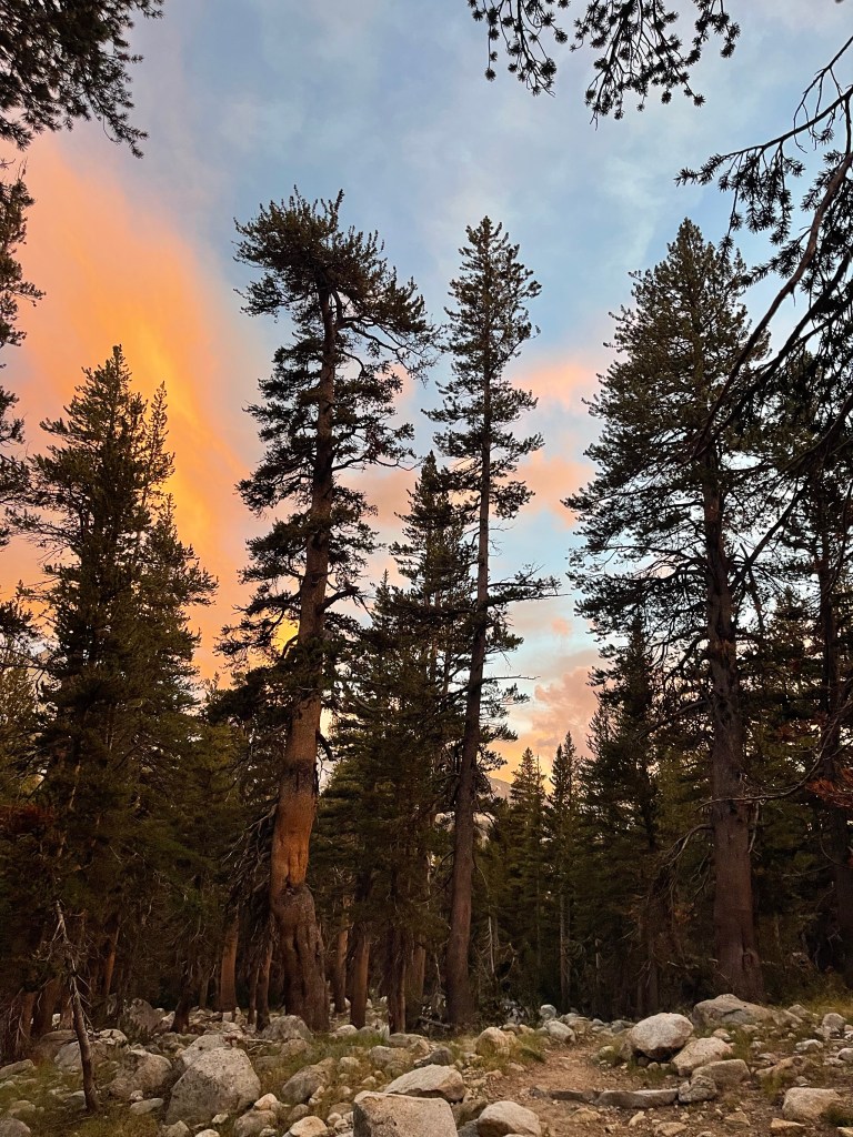
On day 4 I resupplied at Reds Meadow and left around 11 am. I had a lot of elevation gain right out of the gate. At Reds Meadow I was at 7,705 feet. Within 5 miles I was at 9,100 feet, and then another 3 miles I was at 10,100 feet. It was a long walk up there, I stopped to drink water and catch my breath frequently. The trail was very pretty and I could see all the peaks surrounding me in the John Muir wilderness. They stick right up in the sky like arrows and most have snow on the top. I enjoyed this part of the trail, there were great views, sunshine, and a slight breeze to keep me cool as I worked uphill.
As I was nearing 10,000 feet I ran into Mark and Mark. Two John Muir Trail (JMT) hikers I passed the day before! It was good to see them again, I thought they were way ahead. We talked about the elevation and how hard the hiking was. They let me pass them and told me they were camping at Purple Lake. I had planned to hike 2 miles past purple lake to Lake Virginia, but after they told me they were camping there I decided I would to. It’s nice to have company at camp and have people to talk to while eating dinner!
I cruised the last mile to camp and we found that there was a couple from England at the campsite too! Their trail name was m&m because their names were Marty and Maria. They started the PCT northbound on April 20th. Today was their 2,000th mile! They had to skip around because of snow and fire but still made it to the Sierras. They said they might not be able to finish their entire thru hike because their visa will expire. I wish they had more time to hike it all! We talked for a while and they were really supportive of my hike and gave me some information about the trail ahead.
I ate another dehydrated meal for dinner, Louisiana red beans and rice! It was pretty tasty. Before getting into my tent for the night there were 4 other hikers that showed up to camp. It was kind of nice to be sharing camp with other people for once. Hopefully this continues to happen! Anyway, I hiked 13.7 miles this day. Not a whole lot but I was wiped after the elevation gain and all.
Day 5 was another great day. I woke up early around 6:30 and said goodbye to my campsite friends.
The day had a lot of up and down, like usual on the trail. I gained 2,630 feet and lost 4,690 feet.
I walked to Lake Virginia which was beautiful with the morning sun shining on it!
I continued on down to Fish creek which had an amazing bridge still intact. As I walked across it I said a special thanks since there’s been a couple bridges ruined from the snow.
Going down to fish creek felt like I walked down 100 switchbacks. And then I had to go up to Silver pass which felt like I walked up 100 switchbacks. Along the way there were amazing views of lakes and creeks. It really felt magical. Everything was so bright and green it didn’t look real. I walked past Nüümü Hu Hupi which was just as breathtaking as Lake Virginia. I collected some water here and got ready for my last 1.5 miles to the top of the pass. I haven’t listened to a lot of music since starting the hike so I figured I would listen to some on my last climb of the day. Just before I got to the top of the pass “Closer to home/I’m your caption” by Grand funk railroad came on shuffle. Last year I found that this song always came on at the right moment, just when I was nearing the top of the climb. It felt great to get to the top just as the song ended. I encountered a little bit of snow but there was a good enough boot pack that I didn’t need my microspikes. I had a quick lunch on top around 11 am and then continued down into the valley. At this point I decided that I would go into Vermillion Valley Resort. This is another campground friendly to hikers. From the top of the pass to VVR I had about 7 miles to cover in 5 hours. I was able to just cruise downhill. And there were even more switchbacks! I had to go from 10,994 feet to 7,800 feet. It was killer on my feet. Most of the trail was rocky and required some attention so I didn’t trip and fall. I met lots of hikers going uphill and felt bad for them since it was getting quite hot out.
I saw a great waterfall cascading down the rocks I was walking next to. It was getting so hot out that I wanted to jump in and slide down the waterfall. Instead I just ducked my head under some of the smaller waterfalls and creeks on the trail.
I saw a NPS crew doing trail maintenance and I felt even worse for them having to work in the heat with pants and long sleeves on. I did say thank you to all of them though for the work they do. Without them the trail would not be possible!
I was passed by one group of hikers going downhill and for once I didn’t feel the need to chase after them so I could pass them. That’s progress!
The trail eventually flattened out a bit before I made it to the junction with Edison Lake. This is where I had to walk 1.5 miles to where the VVR ferry picks up hikers. It didn’t take me long to get there. The ferry picks up hikers at 9:45 and 4:45 everyday to bring them to the resort. I was about an hour and a half early for the 4:45 ferry. But there were 5 other hikers waiting so I was able to meet some new people and soak my feet in the lake. It felt really great to sit in the sun, but I might have overdone it because now I’m a bit sunburnt.
I got on the ferry and we saw some smoke coming from trees down by the resort. The guy driving the boat, Raven told us that crews were working on it. Hopefully it doesn’t affect the PCT.
Raven also threw on some tunes for the 30 minute boat ride. It was pretty relaxing and kind of a weird experience. I didn’t think I’d be riding a ferry with a bunch of other hikers on this trail but there I was!
I got to VVR and was blown away by how hiker friendly they are! I got a free cold drink as soon as I got there and a rundown of services available. I paid for a shower, $8 for 8 minutes with free towel and soap! They even have loaner clothes you can wear while washing laundry!
I checked out the hiker boxes which were the best I have found on the trail. There were granola bars, dehydrated meals, oatmeal, and snacks all still in their packaging! Most of the time you just see a ziploc bag and hope that it’s actually oatmeal inside or something edible at least.
I had a nice dinner and milkshake and talked with some JMT hikers about their hiking plans. I was hoping my plans would line up with theirs so I could have friends to walk with. I guess I’ll see how those plans go. I went to bed later than I have normally since there were so many people to talk with and a bonfire going. VVR was spectacular and I’m really glad I chose to come here.
I only did 14.9 miles but I know I can start picking up the mileage soon so it’s okay for me to take some easy days and enjoy myself now.
Day 6 was another good day! I slept in til 6:30 and got up to have breakfast! I had scrambled eggs, 2 pancakes, hashbrowns and coffee! The maple syrup and coffee were warmed by a woodstove inside the cafe. I ate with Annalies, Collin, and Ryan, three hikers I met at the ferry junction. We figured out our plans for the day and swapped hiking stories. We decided to leave VVR at 11 on the shuttle to the Bear Ridge trailhead. So, we got to packing up! It didn’t take me long so I had a lot of time to do some yoga and stretch which felt great. I paid my bill and bought a VVR sticker for my bear can. Then we loaded up the truck and headed out. The Bear ridge trail connected us back with the PCT/JMT. On this trail we gained about 2,300 feet in just over 4.6 miles. It was tough to get going after eating 2 huge pancakes, but I pulled through. Annalies, Collin, and I went this way and Ryan took the Bear creek trail. I hiked for the rest of the day with Annalies and Collin. They are a couple from Pennsylvania, and use to live in San Diego. Annalies hiked 700 miles of the Appalachian trail!
The whole day we shared stories and talked about the trail. It made me so happy to have people to hike and talk with that are going my pace.
Once we connected back with the PCT it was about 1:30. We saw Mark and Mark! I knew I’d see them again!
We had to hike down to Bear creek which was a 900 foot descent to 8,900 feet. We had a quick water break and powered on. We wanted to get over Seldon Pass since rain and thunderstorms were in the forecast Saturday. So we hiked on 7 more miles to 10,913 feet! We walked through Upper Bear creek meadows which was magical. The grass was so green and there were small waterfalls cascading over some of the rocks near the trail. We were walking next to a mountain and it just didn’t even feel like we were in California anymore. I told Annalies and Collin that if I were a marmot that is where I would live. I was a little jealous of the people setting up camp there. We continued on.
We got to Marie Lake just before the pass at 5:47 exactly the time Collin predicted we would get there! This was so beautiful. There were little islands on the lake and it was enclosed with giant mountains. This was another great spot to camp, but a bit windy and cold.
We made it the last .8 miles and 400 feet of ascent to the pass by 6:15.
This was a great view of the wilderness ahead of us.
We stayed up there long enough to take pictures and sip some water and then headed on the last 1.9 miles to camp at Sally Keyes Lakes. The last couple miles were downhill and easy going. We made it to camp before sunset and I was able to eat dinner in my sleeping bag! It was nice and toasty.
It was a long day since I got a later start but nonetheless it was a great day hiking. I went to bed around 8:45 which is the latest I’ve gone to sleep so far. Annalies and Collin were camped just 10 feet away from me. It made me happy to have some hiking buddies again!
On day 7 we crossed the dreaded south fork of the San Joaquin River!!! Since I found out the bridge was out this crossing has worried me. But I’ll get to that!
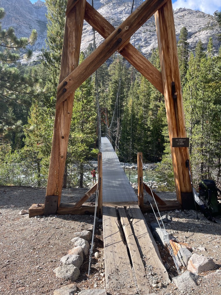
We woke up early, I woke up at 5:15 to the sound of a dog barking. Which was strange. I think it was barking at some wild animal, maybe a bear. We left camp at 6:30 while there was a brief window with no rain. That night there was a thunderstorm and we assumed it would roll into the rest of the day too. We hiked about 6 miles down to Muir Trail Ranch. This is another popular resupply stop but you have to send a box way ahead of time and organize with them. I obviously didn’t. But I had been thinking that it would be nice if I didn’t have to go over Kearsarge Pass, which is an extra 7.5 miles (non PCT miles). So I thought that if I could get an extra three days of food out of the hiker box then I would push on to Lone Pine and be able to hike the rest of the JMT with Annalies and Collin. The JMT and PCT are the same trail from here on out. And I was blessed by the hiker box gods. There were tortillas, pistachios, goldfish, max and cheese, an unopened jar of Justin’s peanut butter (my favorite!) and a bunch of oatmeal. I had plenty of food for the next 8-9 days. We had an early lunch there, at around 10:30 before we kept on hiking. There wasn’t any more rain or thunderstorms for the rest of the hiking day, but it did start to rain at camp that night. We had some uphill and downhill for about 6 miles while we dropped into Kings Canyon. This was amazing. We were walking between two mountains along the San Joaquin. Then we finally made it to the infamous bridge! So many people skipped this section of trail because the bridge is out. It was broken because of all the snow piling on it this winter. There were reports of people walking over the bridge when it was still somewhat intact, and reports of people fording with the water up to their stomach. We heard good reports that the water had lowered and it would be at about our waist. Sure enough it went up to my shorts and was pretty quick moving. But we made a line and just steadily walked diagonal to connect with the other side. When we got there we cheered with our water bottles and felt so relieved that it was over with. I have been thinking about that crossing a lot and it felt so good to ford the River rather than doing a huge detour. We hiked on to Evolution Creek where we took a nice long break. This was another high water section and the water went up to my knees but wasn’t moving nearly as fast as the San Joaquin. This was a beautiful creek that had a nice waterfall flowing next to the trail. It felt so relieving to just stand in the middle of the cold water and let it reduce some of the swelling in my legs. We hung out for 30 minutes and decided we would head the last 2.5 miles to camp.
The last part of the day was tough. It wasn’t that we had any extreme ascents or descents but the extra weight of the food and the late night the night before made us sluggish. We worked up the last switchbacks and I felt like we were all dragging our feet. Eventually we made it to camp at around 5:50. We hiked 15.4 miles and climbed close to 2,244 feet. I quickly set up my tent while being eaten by mosquitos. I had a super tasty dinner of Mac and cheese and was very excited to go to sleep early.
On day 8 we woke up to a thunderstorm. We weren’t expecting this so it surprised us. We stayed in our tents until 8:30 and then packed up and left once the rain let up. Hiking in the rain is one thing, but having to hike over a pass in a thunderstorm is another. We walked 2 miles and then had a discussion about the plan for the day. We could either find a safe campsite and wait for the storm to pass, or we could hike and see if the rain lets up while we are walking. We decided to just keep going since the rain let up a little bit and we hadn’t heard any more thunder.
I was sooo tired that morning. It just felt like everything was so heavy. I was wearing all my rain gear which made me feel like I was wearing a sauna. Eventually we met some northbound hikers that told us to at least hike to Wanda Lake and then decide. We hiked from 9,600 feet to 11,438 feet in about 7 miles. It was a somewhat gradual incline and the farther we got up the more the sun came out! When we knew we only had 4 more miles left we took our rain gear off and I felt loads better. My legs could finally breathe. The walk from our campsite to the top of Muir Pass was beautiful. We walked by a meadow with deer resting in it, several creeks, streams, waterfalls, lakes, and got amazing views of the surrounding peaks like Mount Darwin and The Hermit. It was all so beautiful it didn’t even feel like we were in California anymore.
From Wanda Lake to Muir Pass was 2 miles with at least 500 feet of elevation gain. It doesn’t sound too bad right?
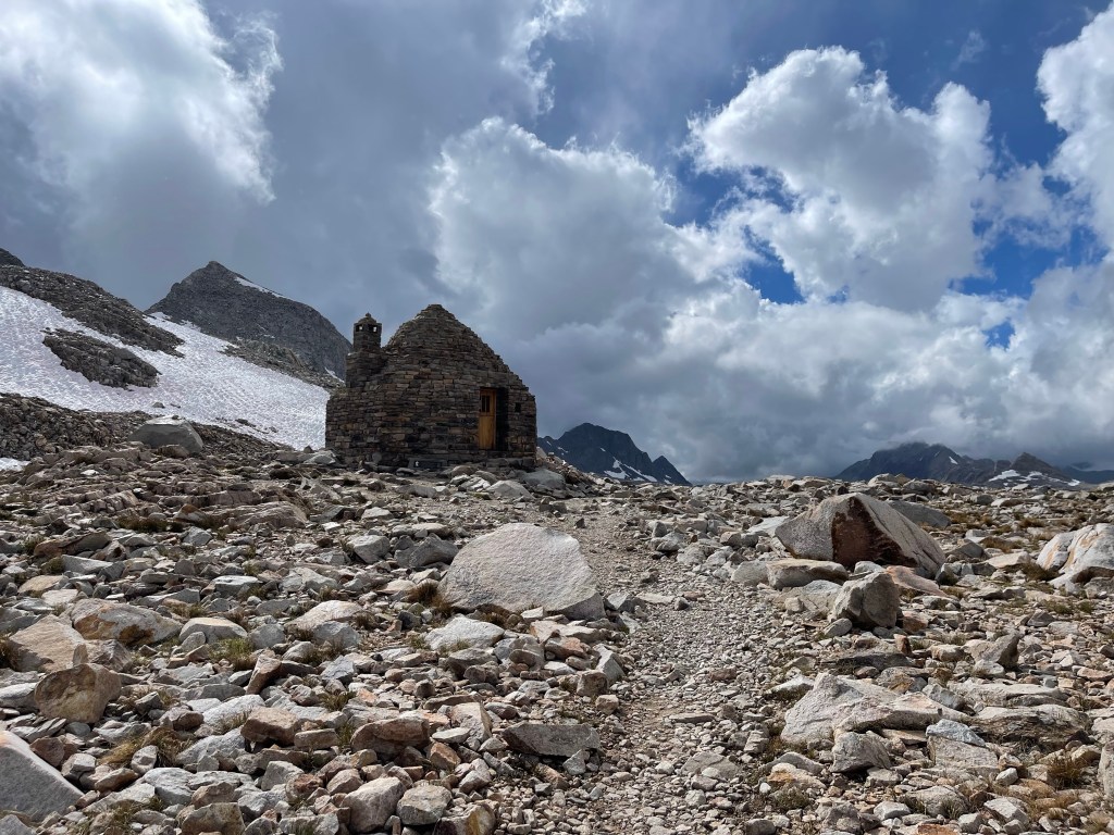
That last 2 miles was tough. You can see the hut at the top but then you see how small the people are on the trail. It felt like we were just walked up an escalator that was descending. Eventually we made it to the top at around 3 pm. It was a late lunch. I was so hungry and thirsty so I got right into hydrating and eating. I laid my stuff out to dry as well since most of my gear was damp.
There were about 6 other people at the hut when we got there. We ate, took pictures, and then geared up to walk to camp.
The Muir hut is only suppose to be used in emergencies. But I don’t know how much use it really is. The inside was damp and had some puddles on the benches and ground. There is also a woodstove, but there is no wood in the vicinity of the pass. I guess it’s good against wind? You definitely can’t stay in there in a thunderstorm, several people have died because they stayed in there in a thunderstorm.
Anyway, we walked about 5 miles to camp which sat at 10,352 feet. I found a nice spot for my tent and set up camp. We had a small fire to try and dry our socks out but I think it only masked the stinky smell of my clothes!
It was a later night and I went to bed around 9 pm. A long day with about 15 miles of hiking and 2,833 feet of elevation gain and 2,700 feet of elevation loss!
Day 9 didn’t rain!
Before we got on trail I went to the bathroom and a bug flew in my mouth! It was so gross, I haven’t had that happen before. So it was a rough start to an otherwise great day. We got on trail by 6:45, we knew we had a long day ahead.
First we had to walk about 6 miles downhill to 8,000 feet. This was a quick 6 miles which took us about 2 hours. We filtered some water and then began the climbing for the day. We had about 4,250 feet of elevation gain over 10 miles. There were lots of blow downs and wet creek crossings. It didn’t feel like we were gaining that much elevation until we stopped for lunch and we were 1,000 feet higher than our last water stop. We made sure to take several water breaks so we weren’t just carrying extra water up and over the pass, this also gave us time to rest.
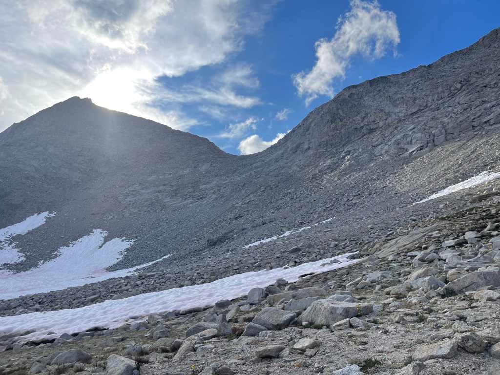
We had a nice lunch at the top of a water fall and left around 12:45 to continue on. We walked up several switchbacks and it felt like Mather Pass was taunting us. We couldn’t figure out where the pass actually was and for the 9 miles of the ascent it was pretty hidden. We passed several NOBOS on their way down who told us the snow wasn’t an issue. We passed two SOBOS who told us we were doing a great job, and we said the same to them! It was nice to have some encouragement on such a long uphill hike. Finally we were half a mile and 500 feet from the top. This is where things got spicy!
There were two snow patches covering switchbacks. We went across one and just as I stepped on the snow I remembered hiking with Rene and Miia. I had a flashback to Miia saying that if you are doubting if you need microspikes, you need microspikes. And sure enough I could have used them. I slipped on the last patch of snow and scraped my arm on a rock I postholed into. It wasn’t a big fall but enough for me to be a bit mad at myself for being over confident in the snow crossing. The next patch of snow was scarier and I put my spikes on. I made it through with no problems.
We finally made it to the top and I was sooo happy. At that point we had hiked 16.7 miles. I took out my cliff builders bar I had been thinking about for the last mile of the ascent and savored it.
We left after 15 minutes of resting to start the 2,000 foot descent over 5.5 miles to camp. We could see the trail stretch out from the top of Mather which was pretty neat. No snow, just some washed out sections of trail.
I knew this was going to be a long walk to camp so I listened to a podcast. My friend Maura recommended the Giggly Squad to me and it was the best thing for me to listen to. I was laughing out loud listening to it, which felt good! As much fun it is to be hiking, I don’t think I laugh hard all that often so it felt nice on my descent. That kept me entertained all the way til I set my tent up next to Kings River. We got there at about 7. In total we hiked 21.9 miles, my longest day yet! I quickly filtered water, went to the bathroom, made dinner, and hopped in my sleeping bag. I was pooped.
Day 10 was a long day. We hiked 16.5 miles total with at least 4,000 feet of elevation gain. We got a later start since we wanted to sleep in. We didn’t leave camp til 8:45. We had 4 miles uphill to Pinchot Pass which sat at 12,127 feet. This wasn’t a terrible climb. The pass was pretty obvious and there weren’t any terrible snow fields. We saw a marmot on the way up that was pretty close to trail which I enjoyed. We finally made it to the top at 11:30 and there were 7 other people up there! We all talked for a bit and I dried my tent out. We had some snacks and then headed down. It was a long downhill to 8,500 feet over 7 miles. We had one tricky part of the trail where the hurricane kind of wiped things out. Then we had a suspension bridge to go over! This was cool to look at but not my favorite thing to walk over. I felt like I was just swaying from side to side, close to falling out! After the bridge we started the last uphill of the day. We had to navigate around avalanche debris. The trail was covered with broken trees/blowdown. So we went up 50-60 feet uphill from the trail to walk on a ledge around it. This was a tricky boulder field! I kept scraping myself on branches and rocks which didn’t help my bug bite infested legs! Finally we made it back down to the trail and we only had 3.3 miles left til Arrowhead lake. We had about 1,000 feet of elevation gain to get there. There were two tricky water crossings and it was tough to keep my feet dry. But it was very cool that once we started climbing uphill we could see the valley and the river we crossed below. It was also nice to see the mountains ahead start peering over the ridge we were on. We saw a couple more friendly marmots and some jumping fish in the streams!
Finally we made it to camp at 7:15. I got to setting up my tent and getting water. I was really tired after hiking in the sun all day. I left my tent fly open while I ate dinner in my sleeping bag. I was able to see the stars coming up over the lake which was really beautiful. I haven’t been able to see the stars much on the hike so far so I treasured this. I had some leftover Kathmandu curry for dinner. I made the bag the night before which is two serving sizes and wasn’t able to finish it. It wasn’t my favorite dehydrated meal but I think it got better the longer it was sitting because it didn’t taste all that bad this night. I went to sleep around 8:30, another nice and early night.
Day 11 was a great day!
We woke up early so we could walk 2 miles and have breakfast at Rae Lakes. This was a beautiful spot underneath Glen Pass and the lake was sooo blue. I had some oatmeal, hot spiced apple cider, and of course peanut butter. We hung out for about an hour and a half enjoying the sunrise and conversation. We came up with our game plan for the next 2 days of hiking which was productive!
We set out at 9:30 to hike over Glen pass. This was tough for me. The night before I took some Benadryl PM that Annalies had. I got a pretty bad rash on my legs and hands and that Benadryl made me sleep so much better and helped the rash. I don’t know what the rash is from, if too many mosquito bites could cause that then that might be it!
Anyway, Glen pass was tough because I was still feeling very lazy and tired. We had maybe 1,500 feet of elevation gain over 1.7 miles to the top. It was switchbacks all the way up and it felt like the top of the pass was teasing me. It looked so close but yet so far away since I knew I had to hike myself up there. The switchbacks were over lots of little jagged rocks and there were bigger boulders and rocks along the mountain side. It was beautiful on the way up, and I really soaked in this pass. At the end of every switchback I just stood and pretended to admire the beauty while I was really just trying to catch my breath and encourage myself to keep going. We made it to a snowfield that covered the last part of the trail. The boot pack in this field made a sort of trench that was so sturdy you could pretty much break dance in it! I didn’t, but if I wasn’t so tired maybe I would have. After the snow we then had a fun little 10 foot scramble to the top of the pass. I love when I have to actually climb up the trail on my hands and feet. We got some cool video of it too.
We got to the top at 10:35 and had a little snack. It wasn’t soon until we had a pretty good group up there. One PCT hiker was next after us and he was going to finish the trail in Lone Pine after flip flopping on the hike. It’s his triple crown! He is a super fast ultralight hiker and had some good stories. Then 2 NOBO JMT hikers joined us. And then we had a real treat. The guy that carried a 20 pound log on the entire Appalachian trail to raise money for veterans came up Glen Pass! He had a real log over his shoulders that he was hiking all the way across the PCT and he was just days away from finishing too. I guess this year the money was going to St. Jude’s. So, if you feel generous you can donate money for Larry the log on the St. Jude’s fundraising site. It was really quite a spectacle to seem him trucking up those switchbacks with a log.
We left the pass at 11 and continued our 4 mile downhill hike to lunch. We had a long lunch drying out our tents and socks. I had a peanut butter and jelly tortilla with some salt and vinegar pistachios, pretty tasty.
I chugged some electrolyte water too in hopes that would make me more energized. And I think it did! We also ran into our first forest ranger who checked our permits! I’ve never had that happen before so I was kind of excited.
After lunch we ran into Carol again, we saw her at Muir Trail Ranch, then farther on the trail at Mather pass. I thought she was way ahead but I guess not, her finishing point is Kennedy Meadows South. She is a really cool hiker. She and I talked for the last 3 miles of the day about desert hiking, work, and airport disasters. We parted ways when I got to camp but those last miles of the day flew by talking to her. We said goodbye, but like I’ve said it’s never truly goodbye on the trail.
We got to camp at 4 pm. Only 10.9 miles for the day. We didn’t want to go any farther and have to summit two passes in one day, and we were tired anyway. We set up camp and there was another couple set up already. After all our tents were up it looked like an ad campaign for Big Agnes tents!
I went to the bathroom after setting up and had a pretty disgusting first! I dug my cat hole, and after my third or fourth scoop of my shovel I realized I was digging up someone else’s cat hole. That was gross.
After that I went and relaxed by Bubs creek with Annalies and Collin. I washed my legs and soaked my feet in the frigid water. We had great conversation. Like usual. We were laughing for a bit which felt nice. It was relaxing to sit with friends and look at the mountains. The water was very soothing too.
After that we made dinner and I burned the crap out of my Kung pao chicken. Like so bad. It smelled awful and I thought if I put franks red hot in it it would mask the burn. It didn’t. So i ended up eating a packet of tuna that had quinoa and beans in it.
After dinner we had yet another lively discussion of our hiking plans and then eventually said goodnight after settling on the same plan we settled on that morning. We go in circles sometimes.
We went to bed around 7:30 so we could get up early. It felt great to get to camp early and just relax and wind down before jumping in our sleeping bags.
Day 12 was my last full day of hiking with Collin and Annalies. We woke up early and left camp by 6:40 am. Our friends that we made at that campsite the night before, Ally and Jerry, left at 6.
We had about 3,000 feet of elevation gain over 4.8 miles to the top of Forester. Forester Pass is the tallest pass on the PCT! I was really excited to wake up early and go, this is a pass I’ve been thinking about since last year.
The climb started pretty gradual and since I was still waking up I didn’t notice how much elevation we were gaining. It was a bit chilly out but I started sweating in my rain jacket so I just wore my t shirt and shorts around 7:30. Our climb up was spectacular. Again we played a game of guess that pass since it wasn’t obvious to us where it might be.
We were surrounded by sharp peaks with snow and beautiful little creeks flowing by the trail. The trail was a mix of dirt and rocks which didn’t felt too bad on the feet.
Eventually we went up some switchbacks and were on the trail up the side of what looked like a little cliff island. That’s the best way to describe it I guess. We hiked up this til we reached snow. The snow was still hard so spikes weren’t super necessary and there was good boot pack. We made it over without fail. Then we were in the home stretch. The pass was looming overhead and we had about 500 more feet to go up. This was all switchbacks with some ice and snow mixed in. We had kept a steady sustainable pace the whole morning and I just wanted to run up to the pass because I was so excited. I held myself back though and kept cool. We had one little snow patch before the last 2 switchbacks to the top. After the snow pass I met a NOBO pct hiker who is also a fellow 46er! That was exciting, they saw my Adirondacks mountain patch and we chatted for a moment before they continued on.
Then we met up with Ally and Jerry to finish at the top. We made it up there at 9:26! We were at 13,120 feet. That’s the highest I have hiked, so far.
After forester we crushed down to about 10,000 feet and kind of bobbed up and down from 10,000-11,000 feet for the last 13 miles of the day.
We had a nice lunch and then only had 5 miles to hike to the PCT/JMT junction. At this junction the JMT goes up and ends at the top of Mount Whitney. With my PCT permit I can summit as well! So we set up camp at Crabtree Meadows around 4:30 and then made a game plan to summit Whitney. Jerry and Ally showed up to so we had a nice group dinner. I had a pretty tasty potato chowder and tried to auction off my Kathmandu curry. No takers unfortunately.
Jerry and Ally shared their leftover food with us which was nice. I got some tasty treats for my last day to Lone Pine. We decided to wake up at 11 and start hiking by midnight for a sunrise summit. We all said goodnight around 7. I packed my backpack for the early(or late?) start and then went to sleep. It kind of felt like falling asleep on Christmas Eve.
Day 13 was one of the best days I’ve had on the PCT, and in my life. I woke up at 11:30 and got ready to leave for midnight. At midnight, Collin, Annalies, Alley, Jerry and I set out on the Mt.Whitney trail. We stayed in a tight group so our headlamps lit the trail a bit better. We aimed to take it slow and steady at maybe 1.2 miles per hour. None of us had tremendous experience summoning mountains for sunrise so we wanted to give ourselves a lot of time to navigate the trail and make the sunrise. We walked up a couple switchbacks and made it to Guitar lake, which is appropriately named. We tried not to wake up any of the campers there either since they were going for a later summit of Whitney. We filled up our waters and shed some layers and continued on. We started up some pretty aggressive switchbacks that were somewhat difficult to navigate since the trail was a bit washed out from the recent hurricane. We kept good time though and stayed in a group. At this point it was getting pretty windy so I left my rain jacket and leggings on. We could see the clear starry night the whole way up which caused us to pause a couple times to admire the constellations. This was really sweet. At the end of the switchbacks we hit the trail junction for Whitney Portal. I left most of my stuff in my tent at the campground since I would have to return later. Everyone else was on the JMT and would be exiting via Whitney portal so they carried everything up until this point. At the junction they shed their unnecessary camping/hiking stuff.
This is when it got even more exciting. We only had 2 miles til the summit. These last 2 miles were so neat. We were walking on a pretty thin path that hugged the side of the mountain and the other side shot straight down it. The trail was lightly covered in snow and a bit icy so we took things extra slow. I turned around a lot to shine my headlamp for Ally and Jerry since there were a lot of steps up and over rocks. It was exciting, but nerve wracking because if you weren’t paying attention things could go wrong fairly quickly. We had one hiker pass us, and she was wearing shorts. The rest of us were all bundled up. She claimed that she grew up running in Chicago so her legs are immune from the cold. I had my shorts on under my rain pants but never got warm enough to just wear the shorts. Our water bottles were freezing, our backpacks were frosted, and we could see our breath the whole way. It was chilly!
We got to the one patch of snow on the trail. Annalies and Collin shot up it and I stayed back to kick some steps for Ally and Jerry who didn’t love the snow as much as me. There were some scary steps but we safely made it to the top. And after the snow we just had to walk a couple hundred feet and we were at the summit.
I couldn’t believe it.
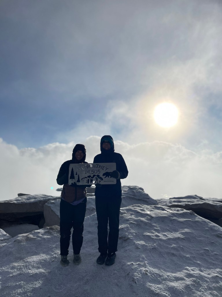
I saw the emergency shelter and then I saw the light red/purple of the horizon before the sun was coming up. I couldn’t believe that we had finally made it there. We started at midnight at 10,642 feet and made it to the summit at 5:40 am and 14,505 feet. It was just about 7.5 miles. I had thought about summiting Mount Whitney since August 2021. It didn’t even feel real that I was up there ( partly because I only got 3 hours of sleep).
We quickly set out our ground sheets and hopped in our sleeping bags it was super chilly on the top. The 5 of us sat in a row on one of the rocks and watched the sun pop over the horizon. There were a couple other JMT/ PCT hikers there that we had been leapfrogging with.
I haven’t done many, if any sunrise hikes or adventures so this was truly spectacular. Everyone was quiet and whispering and it was like we were watching a movie. I couldn’t stop smiling, it was so beautiful. I think a combination of lack of sleep, being with friends, and seeing something so beautiful made me feel pretty emotional. I teared up. Once the sun was up we started on coffee and the 5 of us shared a Nescafé latte courtesy of Annalies and Collin. It felt so great to just be sitting there soaking in the summit and passing around coffee. We were on the tallest mountain in the lower 48 watching a sunrise!
There were lots of clouds moving through and we got some quick looks at the trail ahead and behind. We could almost point out where forester pass is, but mostly we just saw the gray snow capped peaks of the Sierra Nevadas. The summit was all rock with some large flat rocks perfect for sitting on to soak in the sunrise.
Once the sun warmed us up a bit we quickly got out of our sleeping bags and started putting things away. We were in the clouds and tried to take some pictures with the summit signs. But most of my pictures were very cloudy. We sat in the shelter before going down to quickly make some oatmeal. Annalies and Collin also shared some hand warmers with me which were a lifesaver. I was freezing! I had leggings, rain pants, base layer shirt, puffy, rain jacket, beanie, and wool mittens on. It still wasn’t enough to keep me from shivering.
We quickly headed down to the trail and walked the last 2 miles to the junction together. While we were walking I realized that that was the terminus for Ally, Jerry, Annalies, and Collin. They were going to head to town and get a good nights rest in a hotel. Whereas I still had to walk.
I was feeling pretty sad. We had such a fun time hiking together the last week and I was sad to see it end. It ended in the best way possible but goodbyes are still hard. Annalies and Collin lent me their solar charged battery pack so I could use it in the desert. I thought that was very kind. We exchanged contact info so we could get together on the East coast for an adventure sometime. At the junction I shed some layers and got ready to get back to the trail. I didn’t want to rush the goodbye but I knew there would be some waterworks if I dragged it on. We all hugged and wished each other good luck.
I quickly started on the switchbacks down so they wouldn’t see me cry. I think being so tired definitely contributed to my emotions, but I was just sad to not have my hiking buddies anymore.
Last year I think I enjoyed walking alone because it felt like it made me look tough. But there’s not anything quite like hiking partners you can talk to all day about anything, and share once in a lifetime moments with. I cheered myself up by thinking about visiting them and maybe meeting new hikers.
The 7.5 miles to my tent went by quick. I gradually warmed up some more and felt better. It was also really cool to see the trail we had walked on in the dark! There were huge switchbacks overlooking the several lakes below.
At my tent I ate a hearty lunch and then packed up. I planned on hiking 7.5 miles on the trail so my hike to lone Pine was shorter. I met another flip flop pct hiker, the barber. He was from Germany and quite a character. I led us over a stream crossing by finding a log to walk on. I made sure he made it across safely before walking on.
I sped up my hiking because I was really tired and just wanted to lay down in my tent.
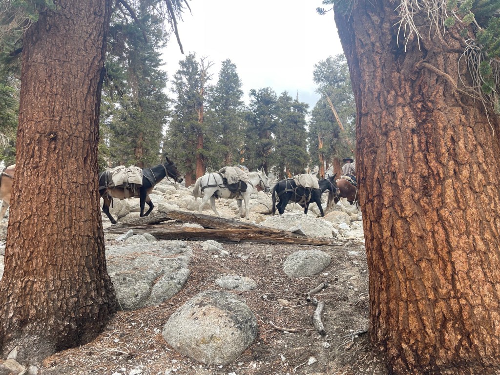
I was about 2 miles from camp when I thought I was having some sleep deprived hallucination. There were 4 horses headed toward me on the trail. I literally wiped my eyes. And then I saw the guy riding the first one and realized, yes this is real life. It was cool to see them pass by, I followed their tracks all the way to my site. I set up early, around 4:30 and crawled in for an early night.
Day 14 was another good day. I slept in a bit and got on trail by 7:15. I only had about 13 miles to hike to get to town. These miles were easy breezy. Some uphill and downhill but I was able to cruise the whole way and made it to the trailhead by 12:30.
From here I put all of my smelly items away so I was able to hitchike better. I walked down to the road and got a ride within 15 minutes. A super nice couple Lori and Carl picked me up and drove me to Lone Pine! We stopped on the way down for a quick snack and to soak in the views. We had amazing views of the valley and mountains, again it felt like I was on another planet. We chatted the whole drive and they told me this was their last full day of vacation. They did a 3 week long road trip up the coast. The Oregon coast was their favorite spot.
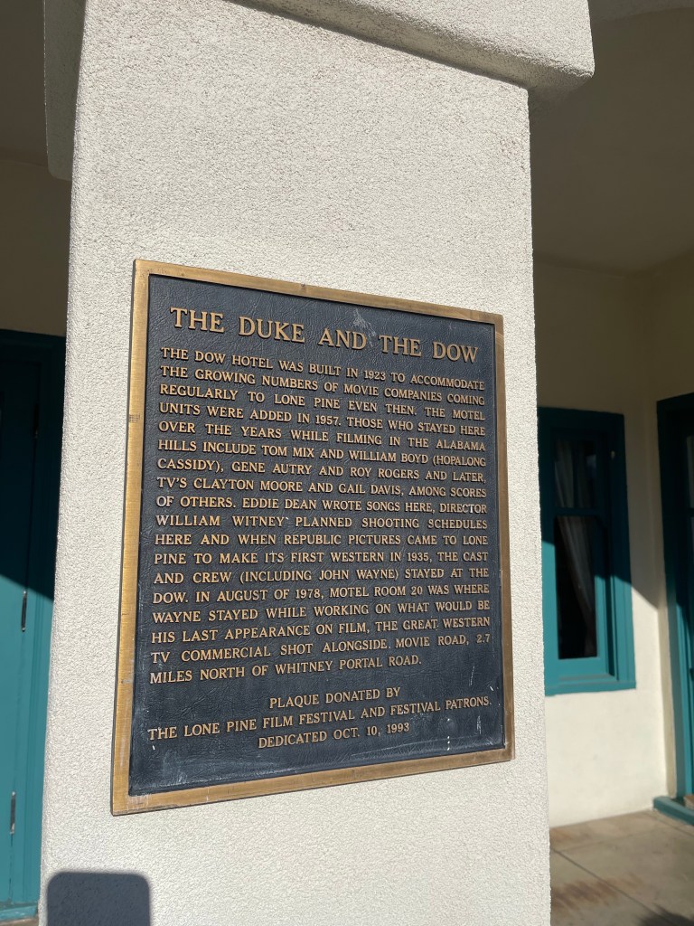
We got a little lost on the way into lone pine but eventually found our way. They dropped me off at the front door of the Motel Dow Villa. We said goodbye and I headed inside to get a room!
I planned to stay two nights since I have to wait for the post office to open Monday morning.
So, I’m going to do some relaxing and eating while I’m in this neat little place!
My friends, Annalies, Collin, Jerry, and Ally left me a goodie bag at the gear shop here! They left me some peanut m&ms and more chocolate with a super sweet letter. I’m feeling pretty fortunate!
After I leave Lone Pine I’ll head to Kennedy Meadows south where I can ditch my heavy bear cannister!


Leave a comment