
On a somewhat spur of the moment decision, my boyfriend and I hiked to the top of Mount Mansfield. Mount Mansfield is the tallest mountain in Vermont. It sits at 4,393 feet!
I went with my boyfriend on April 16th. We parked at Underhill State Park. There is a small parking lot past a couple lean-tos. There were still parking spots there at 10 am on Sunday. I bet this place fills up in the summer though so I would recommend car pooling.
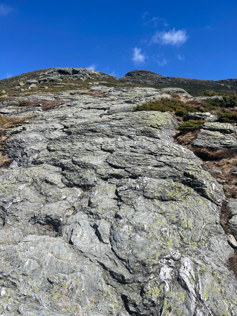
We took one backpack filled with snacks, water, and an extra sweater. The trail leaves right from the parking lot and is pretty well marked. You follow this trail that crosses over the CCC road a couple times for about .7 miles. There is a trailhead and register before you begin the Sunset Ridge Trail. There are a couple of different trails you can take to the top but we just followed Sunset Ridge. The trail is very similar to those in the Adirondacks. There weren’t any switchbacks, it was just straight up and followed a couple creaks and streams.
There was still some snow and ice on the ground but nothing that warranted snowshoes or microspikes. There weren’t any rock scrambles either. It was generally easy going with some gradual elevation gain. Once you get closer to the 2 mile point the trail opens up and you can see the top of Mansfield and the Adirondack mountains! After 2.5 miles, 1.5 hours and 2,536 feet of elevation gain we made it to the top. We moved a lot faster than I thought I could. I’ve been a little out of hiking shape so this was a good hike to get back into things.
We got to the top at 12:20 pm. It was pretty windy but pretty. On the other side of the mountain we could see Stowe, and the ski lifts were still running! That was cool to see. We also had to follow a little bit of the Vermont Long Trail to get to the summit. The long trail is about 272 miles long going from the Massachusetts-Vermont border to Canada (depending on which way you go). This trail is also the oldest long distance hiking trail in the United States. The trail was first an idea in 1910 and the final link of the trail was cut in 1930. It was exciting for me to see the trailmarker for it, might be another hiking goal of mine.

At the top of Mansfield we sat below the summit to avoid the winds and had a nice lunch.
The way back down went quickly even though the melting snow and ice made things a bit slick. I tried to watch my steps and be careful but I ended up slipping on ice and smacking my leg on a rock. It hurt, and I swore pretty loudly. I still made it down to the car though so that’s what matters. I slid on some of the smooth patches of rock too which told me I need to buy some new trail runners. Mine have gotten pretty smooth, they were the last pair I used on the PCT.
We made it back to the car around 3 pm. It took us about 4.5 hours to go 5.2 miles. Not too bad given that we took several water breaks and had a long lunch at the top.
Overall thoughts on the trail
This hike reminded me so much of the Adirondacks. It was rocky, muddy, wet, and windy. All aspects of an Adirondack hike. There were some differences though, the rocks looked different and the trail markers were a little older. Some parts of the alpine vegetation had an attempt of being roped off but it was pretty tattered. In the Adirondacks there are normally several signs and rock paths telling people where to go.
Mud season is also a big deal in Vermont. Some state forest trails are closed during the season and people are asked to avoid muddy trails since hiking during that time negatively impacts that environment. This isn’t what happens in the Adirondacks. Trails do not close, people are just advised to exercise caution when making their decisions on trails to hike. The Department of Environmental Conservation (DEC) recommends recreators avoid trails over 2500 feet until mid-June. The best thing to do when there is mud on the trail is to walk straight through it. When you try to skirt past it you are widening the trail and creating even more mud. If you really want to read more about mud season in the Adirondacks check out this post.
I think this trail is comparable to Ampersand Mountain and is great for someone just getting past the beginner stage.
Also, I got sunburnt on this hike! We finally had some great weather and the sun was out all day. If you burn easily keep that in mind know that we are (hopefully) headed toward warmer weather. It’s important to note too that while it may be getting warmer there is still snow and ice up at the higher elevations. Keep in mind that you might still want some warm clothes or yak traks.
Also, also, going on this hike kind of gave me the idea of going to the high points of each state. I think for now I am going to stick to the East Coast but I am jazzed to have another little hiking project to work on. So far, I only have the high points of New York, and Vermont. But, hey, you’ve gotta start somewhere right?
What I brought
- 20 L hiking pack
- Altra lone peak 6s
- Wool hiking socks
- Running shorts
- Tank top
- Extra fleece
- Baseball cap
- Sunglasses
- Headlamp
- Pocket knife
- Water filter
- 32 oz water bottle
- Jug of water from Stewarts (forgot other water bottles for hiking)
- Food!
- Peanut butter and jelly sandwich
- Honey mustard and onion pretzels
- Fig bar
- Cliff bar
- Chocolate peanut butter (one of the delicacies leftover from my thru-hike food)

Leave a comment