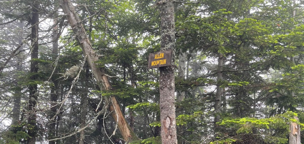
Allen Mountain is one of the 46 Adirondack High Peaks near Newcomb, New York. It is about a 20 mile hike and generally done on its own since there are no nearby High Peaks to tag on. I started this trail at 7 am on June 16th 2022 and made the long trek to tag my 39th High Peak. There is about 3,400 feet in elevation gain on this trail to take you to the top of the 4,305 feet tall mountain. I had no service on this trail until I was near the top of the peak, so this place is pretty remote compared to more popular Adirondack hikes.

The trail is just off of the Upper Works Road and there is a good sized parking lot next to the trail register. My vehicle was the only one in the parking lot when I got there. I signed in at the East River Trailhead and then began walking on that trail. There is a lot of overgrown brush and mud on this trail but nothing you can’t manage. If it is raining or has rained in the past day or so bring a rain jacket/pants and a rain cover because the overgrown vegetation will get you soaked. You follow the East River Trail for about 5.5 miles. Near the beginning of the trail there is an old bridge you have to cross. When I went it was hanging at an angle and honestly did not look the safest. I would let one person walk across it at a time just because of the dilapidated state that its in. The East River Trail will take you around Lake Sally and Lake Jimmy and into some neat sections of woods. There is a small river crossing and people often bring water shoes for this part. However, I hate taking my pack on and off when I am hiking so I kept my trail runners on and was fine since it is a very short crossing. The water does move fast though, so keep that in mind if your shoes are not super grippy. These first 5 miles are relatively flat and it isnt until you are on the Allen Mountain trail that you begin to make the climb. The Allen Mountain trail is more of a herd path than a well maintained trail, so keep that in mind if you get lost easily.
After starting on the Allen Mountain Trail you will gain a a little over 3,000 feet in elevation in about 4 miles. This last stretch to the top was super muddy and pretty terrible at times. You follow what seems to be a small stream mostly to the top so there are tons of baby boulders to navigate (which take a toll on my feet). This rock is very wet and most of it has green or red slippery moss on it. Be careful when navigating this stream because it is very easy to lose your footing and slip on the rock.
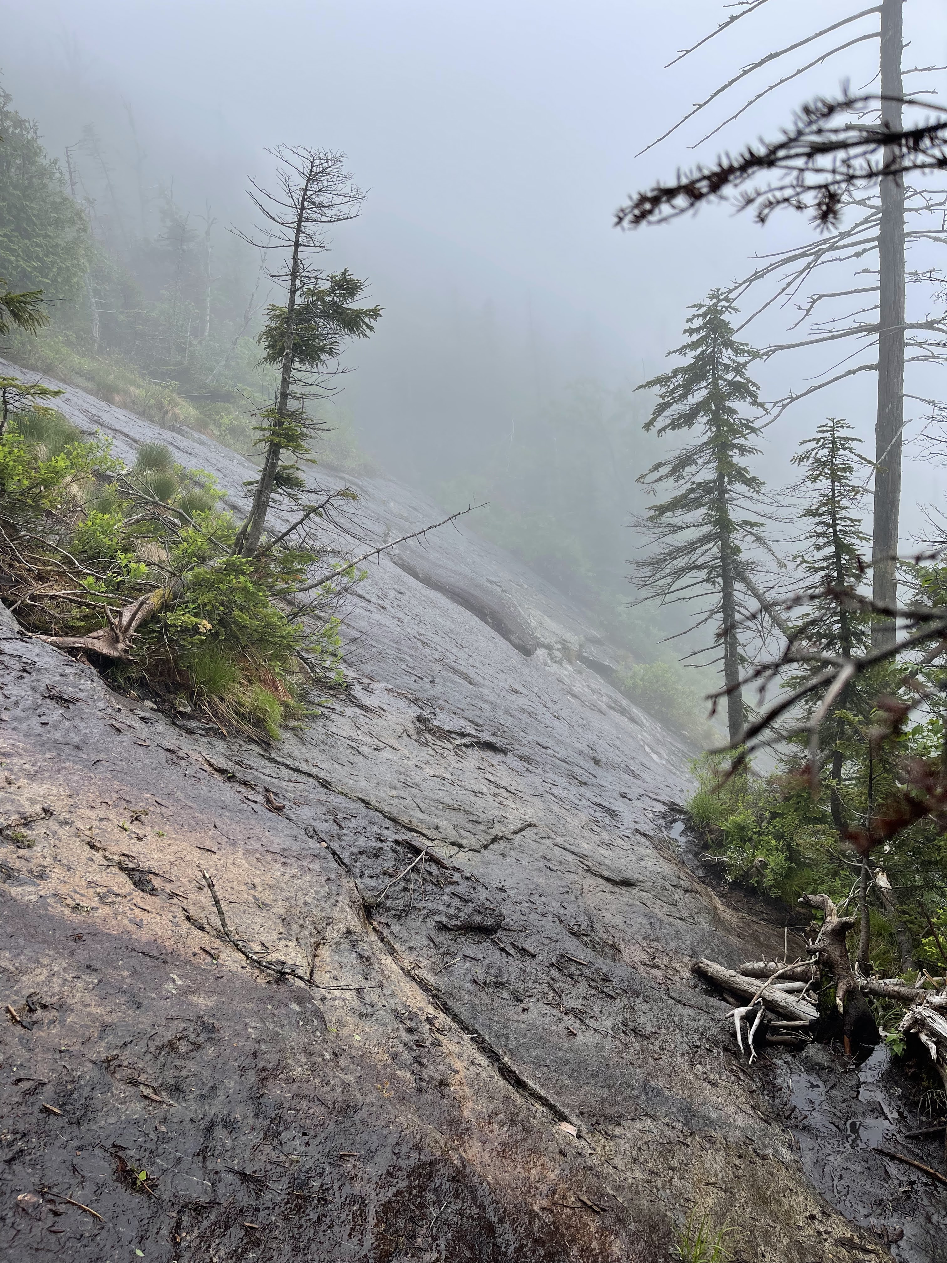
There is also a steep portion of rock where there is not much to grab onto and pull yourself up. I stuck to the left side of the rock on the way up and think that might be the best route to go. It looks intimidating when you reach the rock slide but I took my time and was able to get myself up. When I was hiking there was also a thick fog surrounding the top of the peak so this section of trail was spooky because it looked like I was just walking straight up into that fog.

You keep climbing up and up and up to get to the summit, it felt like forever getting up there but I eventually made it. I knew there wasn’t going to be any views because of the weather so I just made a quick peanut butter sandwich and made my way back down to the parking lot. This hike is an out and back trail so just walk out the same way you came in. Be extra careful going down the slick rock, I slipped a little bit on the way back. This hike took longer than I thought it would, I didn’t get back to my car til 8:30 pm.
Overall thoughts on the trail
This is one high peak that would take some major convincing for me to do again. It was such a long hike for just one peak with lots of mud and challenging sections of rock. I am sure if the weather was nicer then I might have enjoyed it more. But, on the plus side, the trail is extremely remote which I did enjoy. I saw a deer, 38 red salamanders, 3 toads, 1 frog, 1 snake, and my first ever black bear! That is probably the most wildlife I have ever seen on a hike.
Personally, I like hiking alone and having a big chunk of time to myself to think and this trail is perfect for that. However, if you are someone who isn’t into that sort of thing, definitely bring a friend because the trail is long and quiet. I saw one person when I was on the trail.
If you are trying to be a 46er and are planning a trip to the High Peaks, this is a relatively easy one to add on. Don’t let the mileage scare you!
What I brought

Since I am preparing for the PCT I brought my fully loaded PCT pack to do a shakedown hike to get ready, so I am not going to list all that since you definitely don’t need it on this hike.
- 50 L backpack
- 32 oz nalgene
- 2 32 oz smart water bottles
- Sawyer squeeze
- Rain jacket
- Fleece jacket
- Running shorts
- Wool hiking socks (2)
- T-shirt
- Baseball cap
- First aid kit
- Headlamp
- Food!
- Peanut butter sandwich
- Tortilla chips
- Cliff bar
- Hydration mix in one water bottle
- Fruit roll up
- Apple

Leave a comment