
Mount Marshall is the 25th tallest High Peak in the Adirondack Mountains. It is located near Lake Placid, New York. It is the southernmost peak in the McIntyre Range which also includes Algonquin peak, Iroquois Peak, and Wright Peak. Mount Marshall is named after Robert Marshall who is one of the original 46ers. Near the summit of Mount Marshall there is also a plane crash site which I will get to later in this post.
The loop trail I took to Mount Marshall is about 14.6 miles. I started at 6:45 on June 5, 2022. I parked at the Adirondack Loj and surprisingly there were still plenty of spots open at 5:30 a.m that morning. Parking here is not free and information about parking can be found on this website. I paid $15 for the whole day to park here.

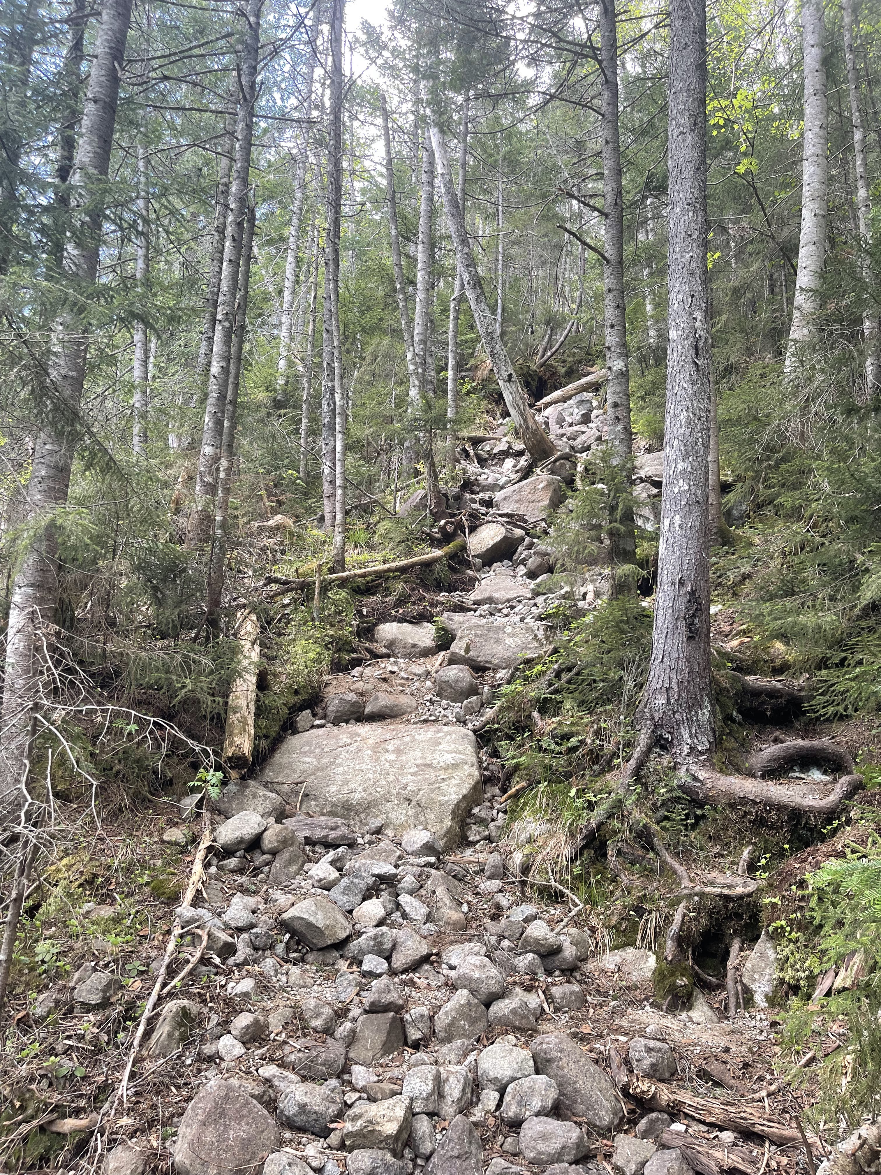
The trail starts near the entrance to the parking area next to Heart Lake. This is one of my favorite little trails in the Adirondacks. You get an amazing view of the mountains in the area and there are plenty of spots along the lake to sit and take it all in. The trail you take most of the way to Mount Marshall is Indian Pass. This trail doesn’t seem to get much traffic, I didn’t see a single person until I was near the summit of Mount Marshall. This also means that it doesn’t see much trail maintenance and sometimes can be a difficult trail to follow because of blowdown and “overgrowth.”
You follow the trail for around .5 miles next to Heart Lake. There will be a sign pointing to continue along Heart Lake Loop or follow another ski trail up to Street and Nye. Take the trail that goes between these two options to continue the right way. At about the 4 mile mark there is an option to continue along Indian Pass or follow a tiny herdpath that connects with Indian Pass about .5 miles ahead. I chose the Herdpath since it seemed like a more direct route, which it was. The path follows closely next to Indian Pass Brook and can be easy to find/lose since it is not a popular path. To go this way there will be a small trail that keeps going straight as opposed to Indian Pass which veers to the left. You do not cross the water on the Herdpath, if you do for some reason you are going the wrong way.
Continue along Indian Pass for another .5 miles and you will reach a trail intersection. Going straight will keep you on the trail to Indian Pass and going left will take you on the Cold Brook Trail, so stay left. At this point you have gained around 500 feet in elevation and still have around 2000 feet in elevation to gain. For 2 miles you follow the Cold Brook Trail. This trail follows a stream so there are lots of opportunities to stop and refuel or cool off in the water. I had a lot of pollen collect on my clothes and backpack so it felt nice to splash some water on myself and “clean up.”
The trail to the summit is also a herdpath with no official trail markers. There will be a rock cairn right in front of the herdpath so keep your eyes peeled for that because if you walk past it you will continue on the Cold Brook Trail. AllTrails states that the summit is .5 miles from Cold Brook Trail, but it felt like it was much longer than that to me. You gain around 400 feet in elevation in this push to the summit which isn’t too bad. But it is a lot of up and down. There was a lot of mud and blowdown which was manageable. At this point in the hike I was just ready to reach the top and get back to the parking lot. Every switchback felt like I was going to turn the corner and see the summit sign, but obviously that wasn’t the case. There was one little climb over a rock and then I made it to the clearing. The top of Mount Marshall is a wooded peak with a sign up high in a tree stating that you made it. There are a couple different herdpaths from the clearing that lead to a rock you can sit on and enjoy the view.
I sat up there a good 20 minutes and enjoyed how quiet it was and ate lunch. I reached the top at 11:40 and headed out to finish the hike at 12. Getting back down to Cold Brook Trail was a lot quicker than going up. To get back to the parking lot you can either go the same way you took up or continue on Cold Brook Trail to the right and take Avalanche Pass then the trails that lead from there to the car. I didn’t really enjoy getting whipped in the face with branches on Indian Pass so I chose to finish on the more “scenic” route. A little ways from the trail to the peak there is a plane crash site on Cold Brook Trail. These kinds of sites are kind of creepy to me but I chose to stop and take a look anyway.

On August 9, 1969 F. Peter Simmons was flying from Long Island to Lake Clear (the Adirondack Regional Airport). He was flying home to a family camp on Tupper Lake. He got trapped in a downdraft as he flew over the High Peaks and apparently knew that the plane was going to go down so he prepared for a sort of “crash landing.” The plane landed between Mount Marshall and Iroquois right before the mountain goes downward to Lake Colden. Simmons was not able to move from the crash because of a broken leg, ankle, and wrist. However, campers down by the lake heard the crash and contacted forest rangers. Rescuers reached Simmons about 17 hours after the crash and brought him down the mountain the next day. He was in critical condition but survived the whole ordeal. The plane is still off the trail and is a popular site for people to look at when they hike Mount Marshall.
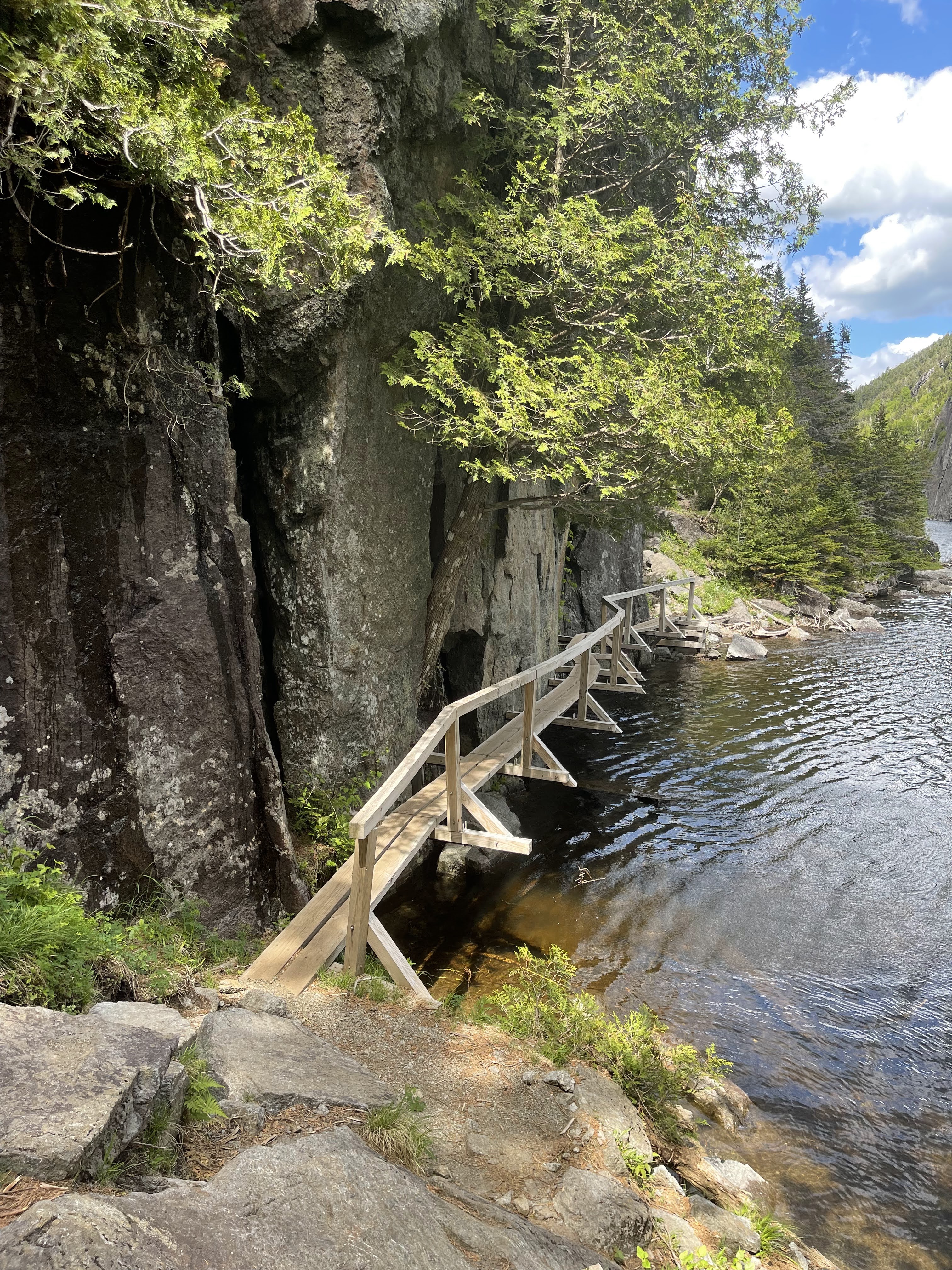
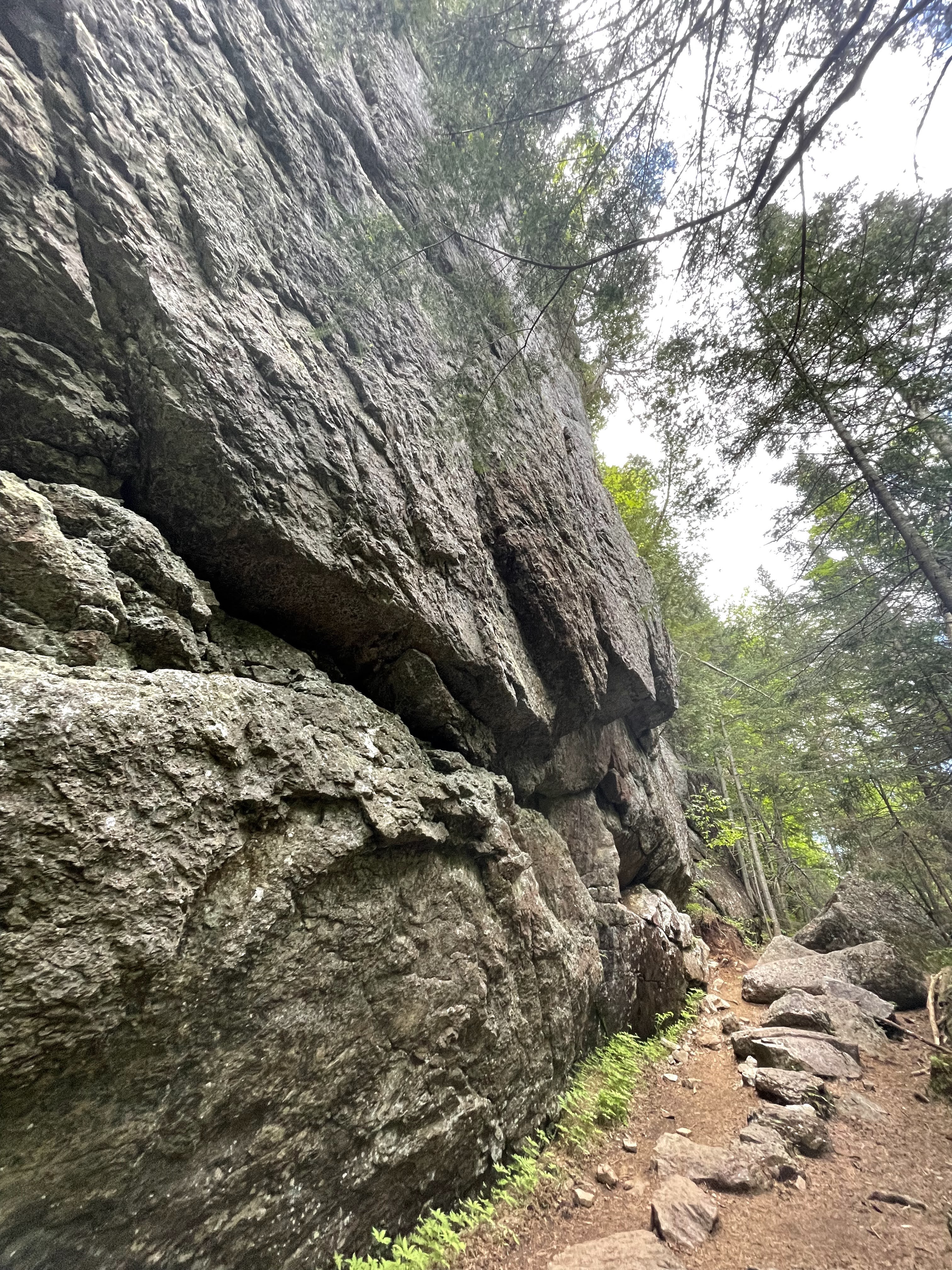
From the plane crash you will continue about 1.5 miles downhill to the NYS DEC Lake Colden Interior Outpost. There is a lot of signage in this area, follow the Lake Colden Trail which will take you to the Avalanche Pass Trail. This was a trail that I walked on in the dark when I accidentally took a 30 ish mile hike last summer. It was beautiful to see in the daylight. Avalanche pass has bridges that take you over the water and right next to the side of Avalanche Mountain. The pass goes between Avalanche Mountain and Mount Colden. There are huge boulders and ladders and is a pretty fun trail to walk on in my opinion. From Avalanche Pass you continue on to Marcy Dam and take the Van Hoevenberg Trail. This trail will eventually connect with the Old Marcy Dam Trail. If you have ever hiked from the Adirondack Loj, this trail will look familiar and will take you all the way back to the parking lot. There aren’t any technical or difficult spots on this trail, just lots of big rocks that will take a toll on your knees. I finished the trail at 4:50 p.m. I took my time on the trail because I had hiked Haystack, Basin, and Saddleback the day before and was a little tired.

Overall thoughts on the trail
I enjoyed this hike because I didn’t see that many people on the trail. It is frustrating to me to be hiking with a bunch of people on the trail because it seems like a constant battle of trying to pass people that may move slower or stay at a fast pace so people don’t constantly pass me. So, if you are the same then this will be an enjoyable hike for you.
The trail on Indian Pass is not popular and is therefore sometimes hard to track as you are getting whipped in the face with overgrowth. So just keep that in mind if you get lost easily.
I think that if you have strong navigation skills and don’t mind being alone for the majority of a hike then this is pretty doable. There weren’t any challenging parts and it was an easygoing 14 ish miles. A lot of people save Mount Marshall as one of their last hikes for the 46er title because of the notoriously boring trail and less than spectacular summit view. I guess I did the same unknowingly since this was #38 of my 46er journey.
Also, I didn’t choose to do this but there is an option of tagging on Mount Colden to this hike which would add at least 4 more miles. You can take a trail by the Lake Colden Interior Outpost up to the summit. You can also make it a backpacking trip and camp near the outpost and get Mount Colden the next day. If you have the energy and the time I would suggest doing this because Mount Colden is a 14 mile hike by itself.
What I brought

- 50 L backpack
- 2 32 0z Nalgene bottles- 1 with hydration mix
- Trail runners
- Hiking pants
- Tank top
- Fleece
- Sunglasses
- Hat
- Rain jacket
- Hiker goo
- First aid kit
- Garmin inReach Mini 2
- Bandana
- Sawyer squeeze
- Headlamp
- Food!
- 2 peanut butter tortilla roll ups
- Peach
- Cliff bar
- Energy Chews
- Snickers bar

Leave a comment