
These three mountains are part of the 46 Adirondack High Peaks near Keene Valley. Haystack is the third tallest mountain in New York! This long hike is worth it because of the breathtaking views awarded on each summit.
I started this hike on June 4th 2022 at 6:45 a.m. from the Garden parking lot. At 5:15 a.m. the parking lot was already full and I had to park about 1.5 miles from the trailhead. I wasn’t sure if the car would get towed or if I would get a ticket parking here, but thankfully the truck was still there when I got done. There was, however, new signs posted that stated “no parking, violators will be towed” after I parked there. So I wouldn’t recommend doing what I did. Parking at the Garden is about $15 per day, and you can find more information about hiking and parking in this area on this website. All I can suggest is to get there very early and to have a backup plan in case the lot is full. Do not car camp/camp at the trailhead because park rangers will wake you up and tell you to leave.
This trail is about 18 miles long according to AllTrails. From the Trailhead you will take the Phelps Trail and follow this for about 3.5 miles until you reach Johns Brook Lodge. This lodge is a backcountry camp open year round for guests to stay at. I have never stayed there but I image it is a nice place to rest up if you are trying to bag a bunch of High Peaks since it is near the major trails. More information about the lodge can be found on this website.
At the lodge it is very easy to lose the Phelps Trail, so just remember to follow the trail that passes by the lodge and not the one that is on the bridge. If you go on the trail over the bridge you will be summiting Saddleback first, which I do not recommend. From the lodge you follow the Phelps Trail for another 4 ish miles and in total gain about 2,700 feet in elevation until you merge onto the State Range Trail. Phelps Trail isn’t too difficult and the mud that I encountered was manageable. The State Range Trail will be to your left and you will follow this for about .5 miles and gain a couple hundred feet in elevation.
The trail to haystack is to the left of the State Range Trail and will take you over Little Haystack then “regular” Haystack. It is only about .5 miles until the summit of Haystack but it is tough. You have to go up and over Little Haystack and then down and over to Haystack. Once you are on top of Little Haystack it seems daunting that the summit of Haystack is still ahead of you, but its not too bad of a climb.
To continue on to Basin, follow the trail down from Haystack. You will see a trail that goes to the right and one that goes to the left. The trail to your left will take you back the way you came so keep to the right. On the State Range Trail between Haystack and Basin you will lose about 700 feet in elevation and then climb up about 800 feet in elevation to get to the summit of Basin.
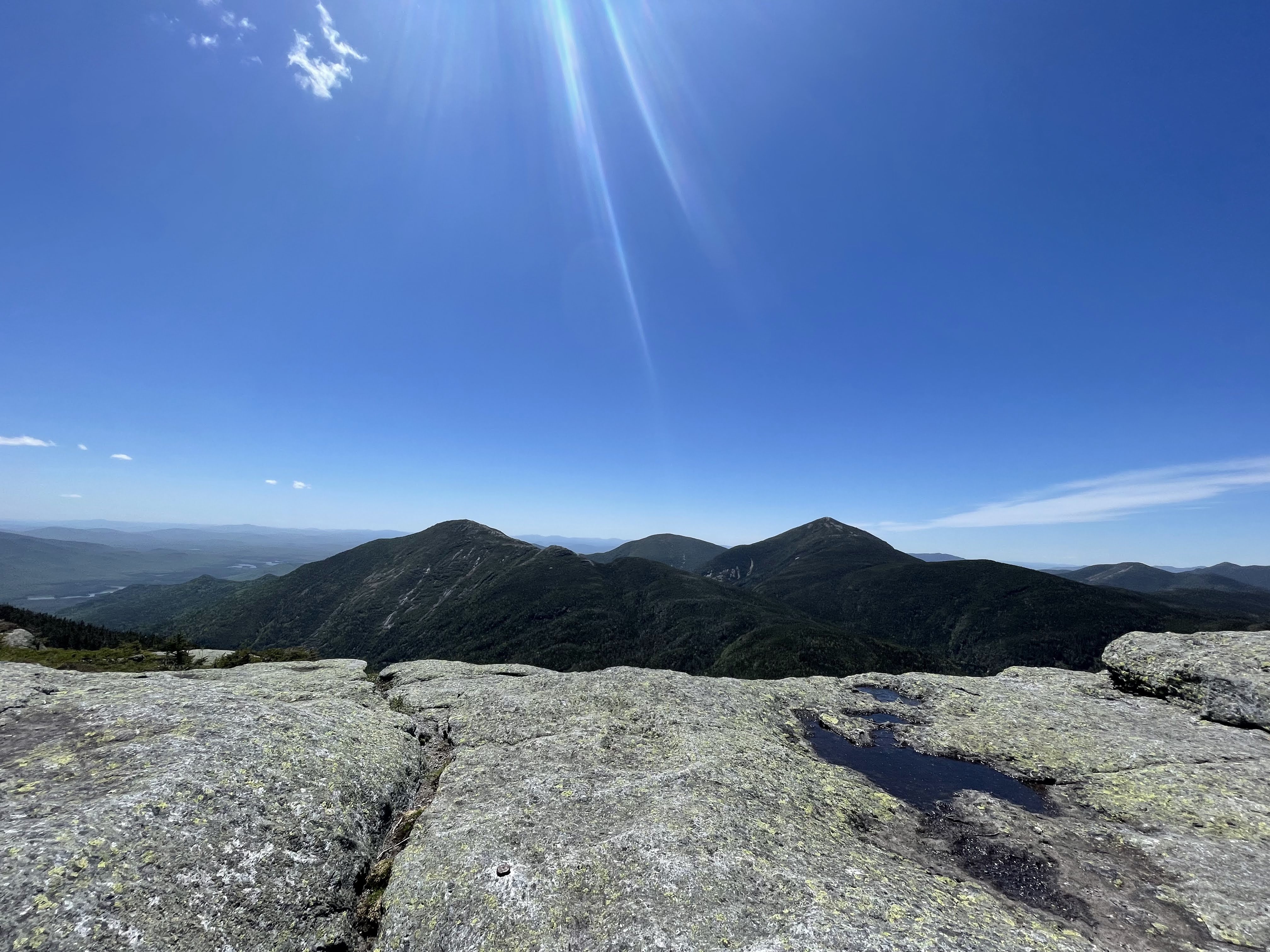
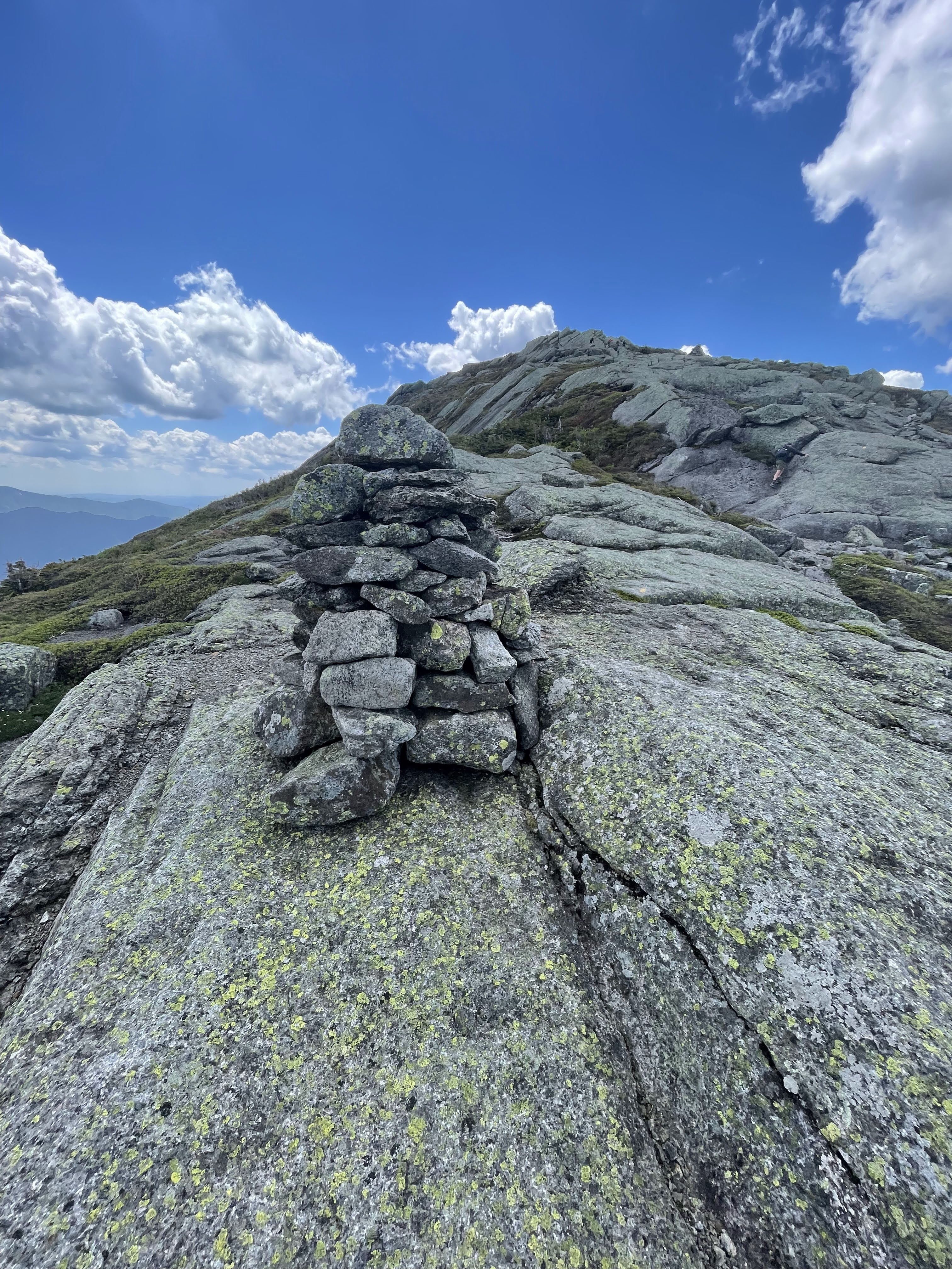
It can be a pretty steep descent and ascent at times and you will probably slow down a bit. There are a bunch of warnings out there about the rock slides between Basin and Haystack but I wouldn’t be too nervous about it, it isn’t much worse than Giant Mountain in my opinion. There is also a ladder in a steep portion of the trail to help you. I reached the summit of Basin at 1:20. Haystack and Basin are about 2 miles apart, as the crow flies, but its a lot of up and down. The view on Basin is pretty sweet and I sat up there for a moment to drink some water and take pictures.
Now onto Saddleback. Continue along the State Range Trail and at about the 11.5 mile mark in your hike is the summit of Saddleback. The trail is pretty easy going for the most part, you lose about 700 feet in elevation then climb back up 500 feet. However, the cliffs on Saddleback are no joke. You will come to a point where it is just bare, exposed rock with yellow paint pointing you in the direction of the trail. It was scary at first because there is no real way around these cliffs and no apparent handholds. I just took a couple deep breaths and figured out the best way up the rock.
My only advice for this section is to go slow and stay focused. Falling from this point in the trail would do some serious damage because there is nothing to soften your blow or stop you from just rolling down the side of the mountain. Play it safe, and if you are scared of being on rock exposed like that maybe bring a friend along with you on this hike. I reached the summit of Saddleback at 2:30. I took a 15 minute break and enjoyed the view. From Saddleback you can see a lot of the tallest High Peaks in the Adirondacks so it is well worth climbing the daunting cliffs.
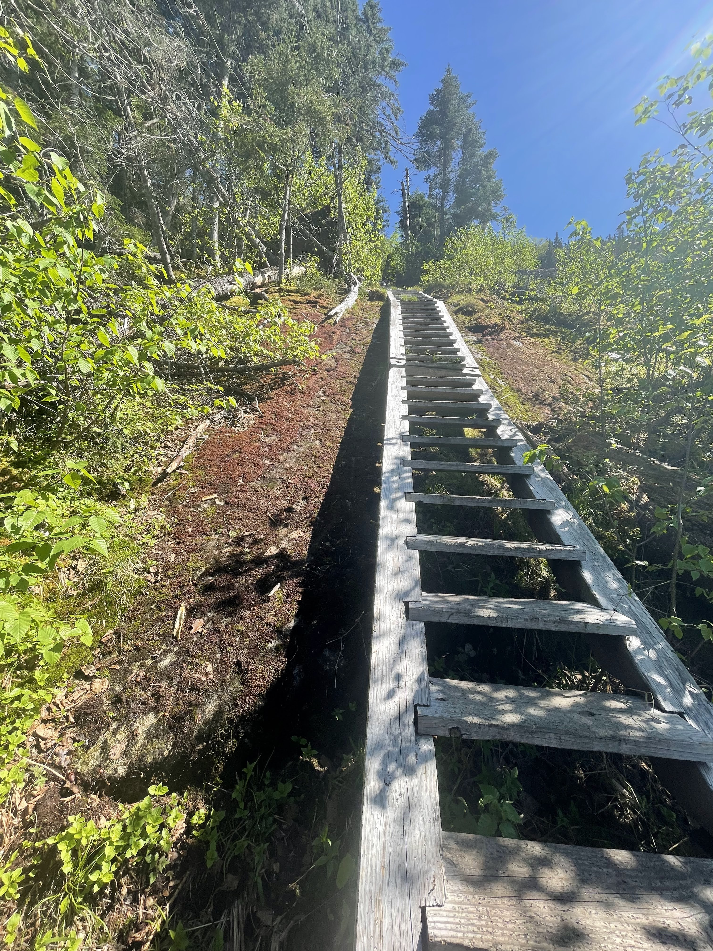
From Saddleback, continue on the State Range Trail. At about 2 miles from the summit you will switch and continue on to the Orebed Brook Trail which is quite scenic. You get to walk alongside a giant rock slide and go down some steep ladders. I think it’s great that these ladders have been added to the trail since it definitely makes it safer. After about 3 miles you will be back on the trail by Johns Brook Lodge, and then about 3 more miles back to the parking lot on the same trail you used on the way in. I was off the trail by 6:15 p.m. It was definitely a long day but a rewarding one, three High Peaks in one go!
Overall thoughts on the trail
I would not recommend this hike to someone who is just starting their 46er journey. I’d say hike Giant/Rocky Peak Ridge, Algonquin/Iroquois/Wright, the Santanoni Range and maybe one other before this trail. You want to be sure that you can handle an all day hike before stepping foot on this trail. Although AllTrails states it is 18 miles I imagine that it might be a bit closer to 20 miles.
I met a couple on Phelps Trail who were confused and didn’t know if they were on the right track for Haystack. They kept showing me their AllTrails app and said it looked like they were going off trail. I think it is great to use an app on your phone to keep track of your hike/where you are but your phone can die and then you have no clue where you are. For this reason I always suggest having a printed version of a map as well as a compass and a portable charger. Don’t rely on one thing as your means of navigation.
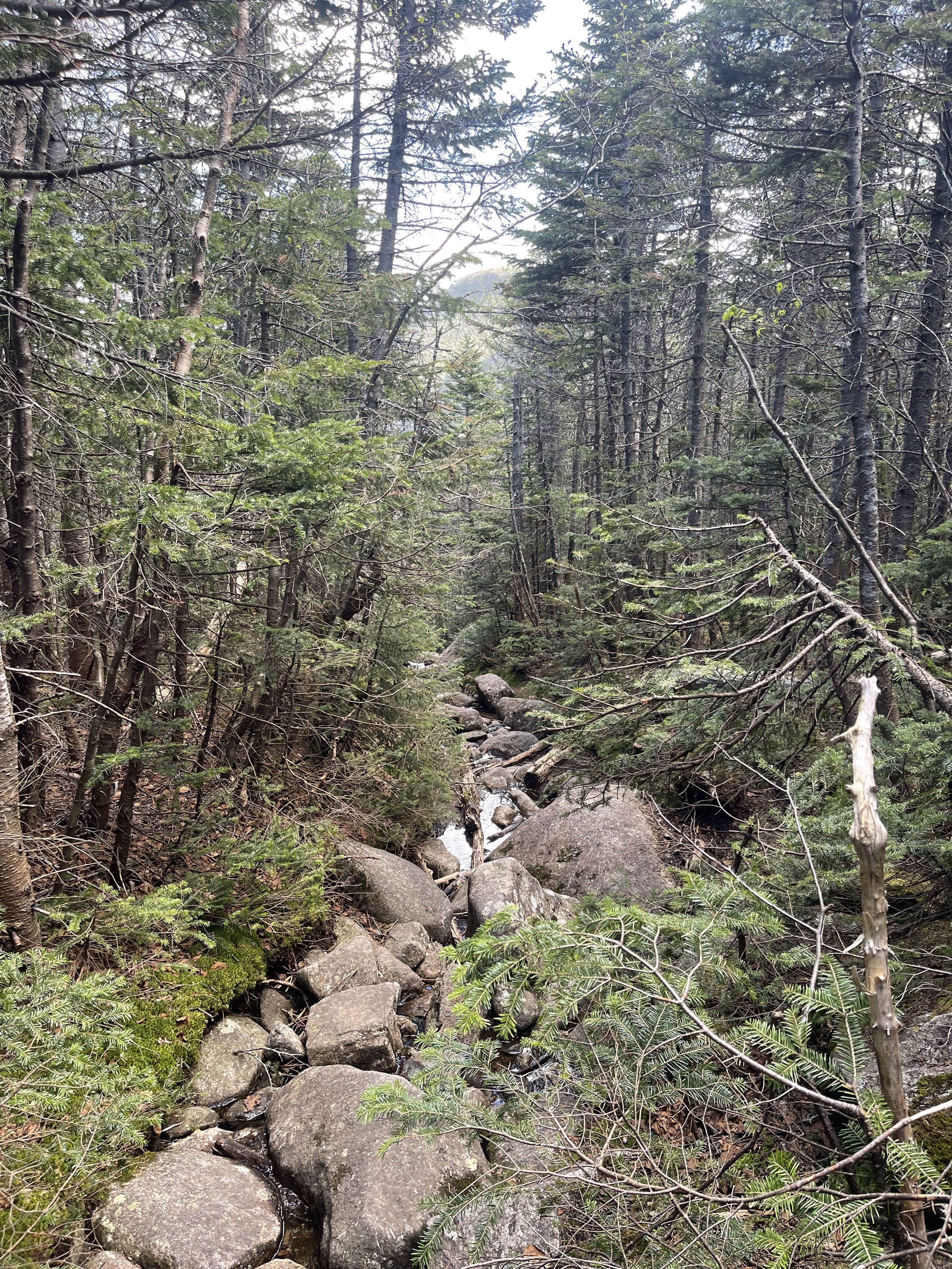
There are lots of spots along this trail to stop and filter some water to drink and to splash some water on your face. I took advantage of this because I was super sweaty and worried I wasn’t drinking enough water, so maybe consider doing the same.
The walk down from Saddleback seemed like it took forever and I just wanted to get back and have some dinner so I started jogging on the way back. At the end of a long day that can be a big ask but it feels great to stretch your legs out. I also stretched and did some yoga afterwards which prepared me for hiking the very next day!
Also, it got pretty cold and windy on the top of Haystack mountain and I was glad to have my fleece and rain jacket to insulate me from the cold. Just because it might be 80 and sunny out when you are hiking does not mean it will be that warm on the summit so always bring an extra layer or two.
What I brought
- 5o L hiking pack
- Fleece jacket
- Running shorts
- Tank top
- Wool hiking socks
- Trail runners
- Garmin InReach Mini 2
- 2 L hydration bag
- 32 oz of hydration mix
- Sawyer squeeze
- Baseball cap
- Sunglasses
- Hiker goo
- Headlamp
- First aid kit
- Map, compass, Swiss Army knife
- Extra pants
- Rain jacket
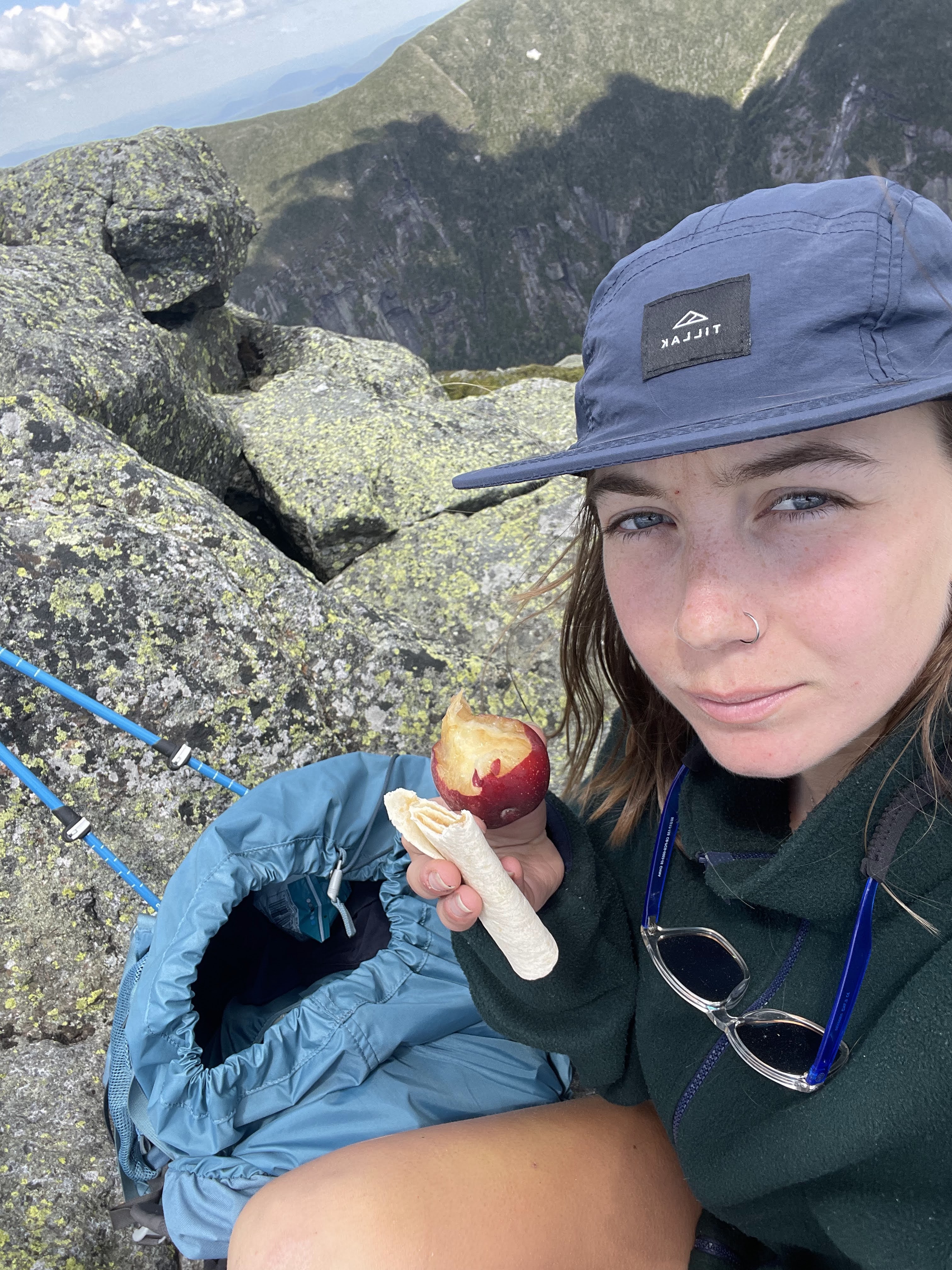
- Food!
- Peach
- 2 peanut butter tortilla roll ups
- Energy chews
- Cliff bar
- Fruit roll up
- Salt and vinegar chips
- Peanut butter filled crackers

Leave a comment