Whiteface and Esther Mountain are two of the 46 Adirondack High Peaks. Fun fact: Whiteface is the fifth tallest mountain in New York State. this hike is about 10.5 miles long with 3,700 feet in elevation gain. it is a pretty rewarding hike since you get two High Peaks done and have some amazing views along the way. this is also a pretty straightforward hike with well marked and maintained trails.
i started the trail on August 5, 2021 at 10:30 a.m. i took the Marble Mountain Trail which is near Wilmington, NY. you follow this trail for about a mile and gain 2,000 feet in elevation in the process. at the mile mark you will take a trail to the left which is called the Wilmington Trail. this trail is the one that will bring you up to Esther and Whiteface. so you follow this trail for about 2.5 miles to the trail junction and gain about 1,000 feet in elevation in the process.
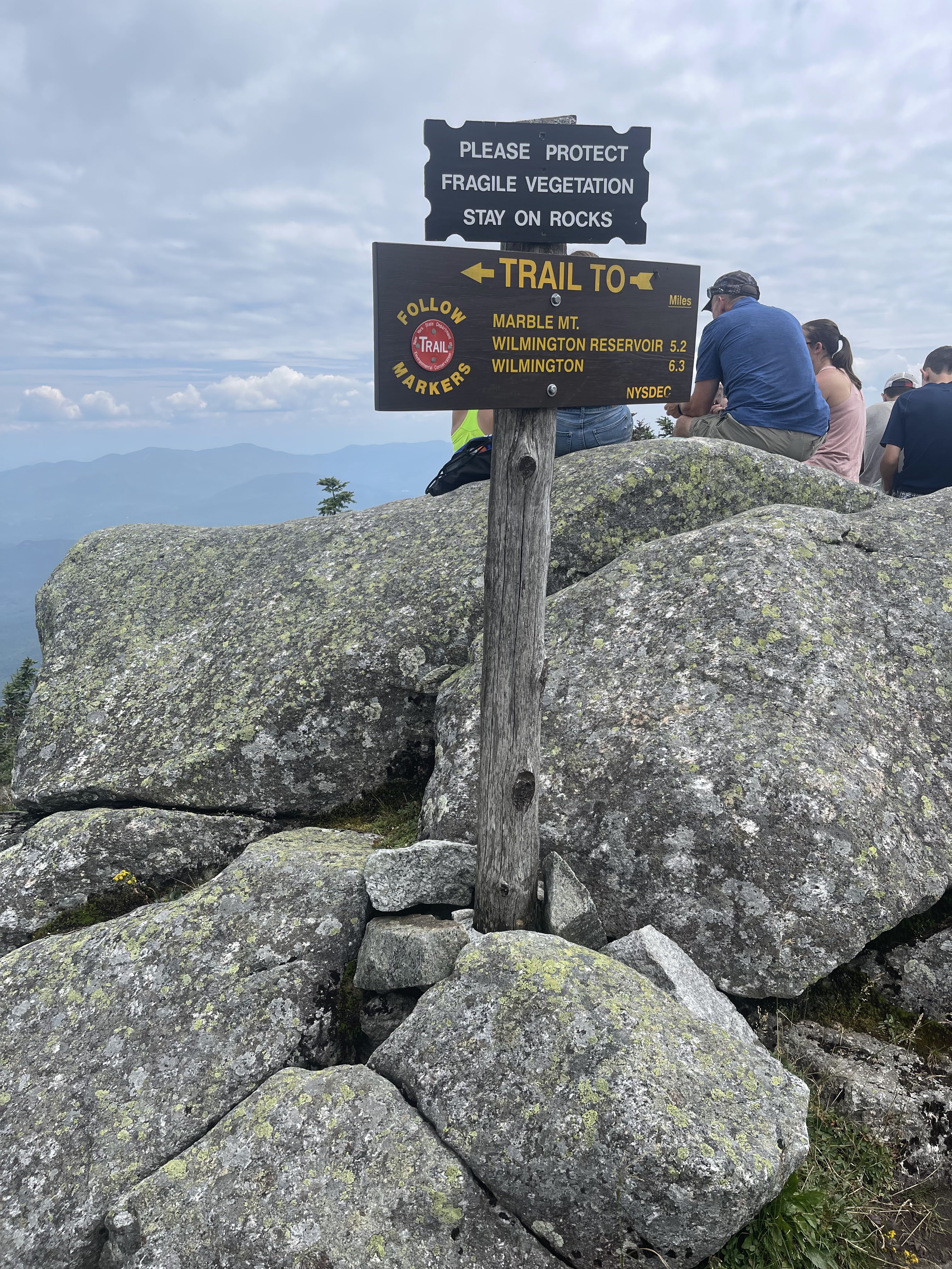
at the trail junction there is a trail to the left that is called the Esther Trail, which like the name implies, will take you to the summit of Esther. the summit is about 1.4 miles from the junction and is a pretty easy ascent. you gain less than 1,000 feet in elevation from the junction to the summit. the Esther Trail is pretty wooded and muddy but an easy and manageable hike. at the summit there is a small clearing that lets you see the summit of Whiteface, other than that the summit is wooded. there is a plaque on the summit in remembrance of Esther McComb. the mountain is named after Esther McComb who discovered the mountain by accident. she was 15 years old at the time and trying to hike Whiteface from the north side and stumbled upon this mountain instead. she made the first recorded ascent in 1839. i made it to the summit around 12:30 p.m.
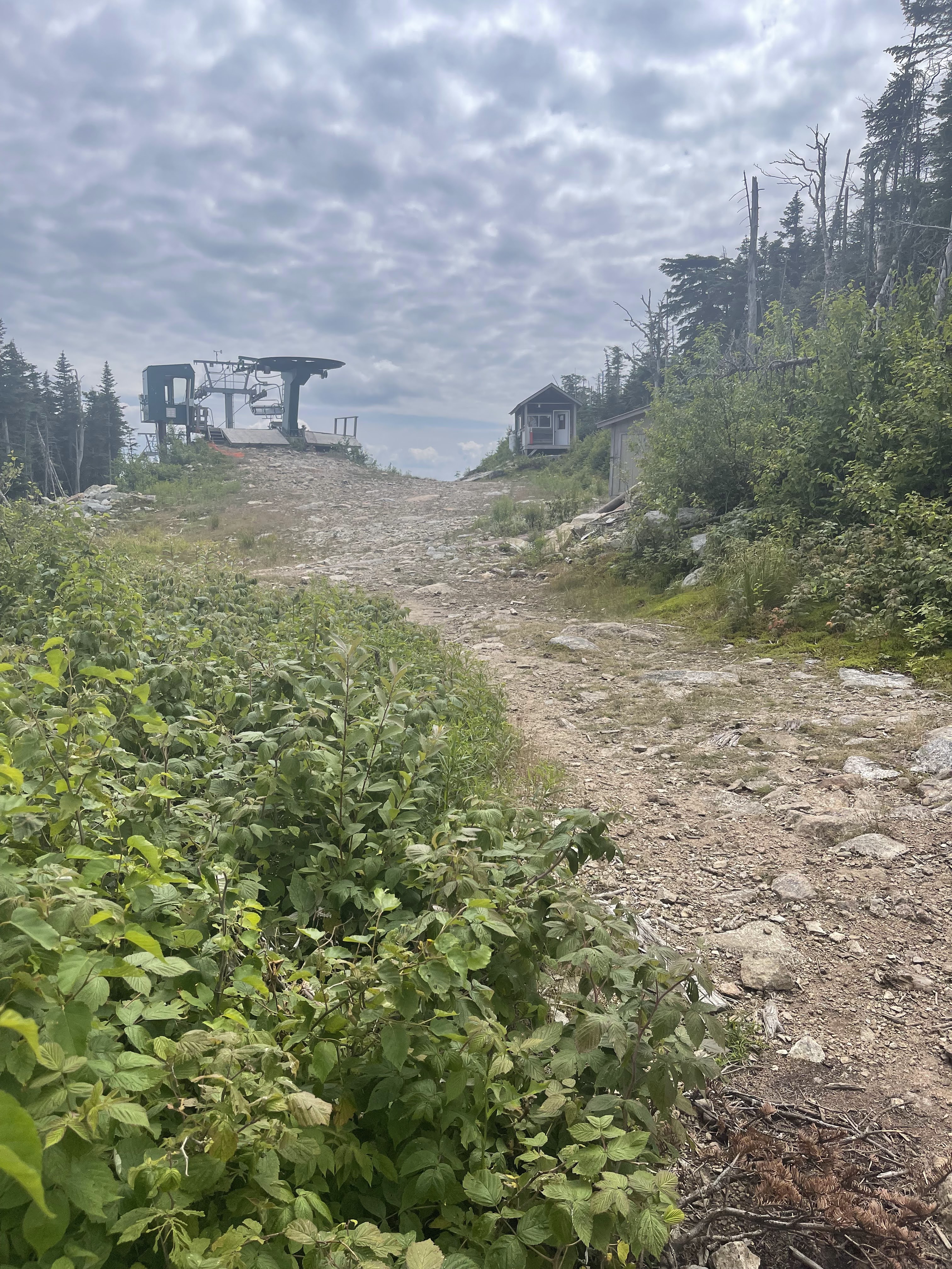
from the summit of Esther, just hike the trail back to the junction. at the junction you will continue on the Wilmington Trail. at the junction you are about 2 miles from the summit of Whiteface with 1,000 feet in elevation gain. this was a fun part of the trail since it isn’t too steep and you can see the ski lifts just off the trail. in the summertime the ski lifts looked pretty eerie.
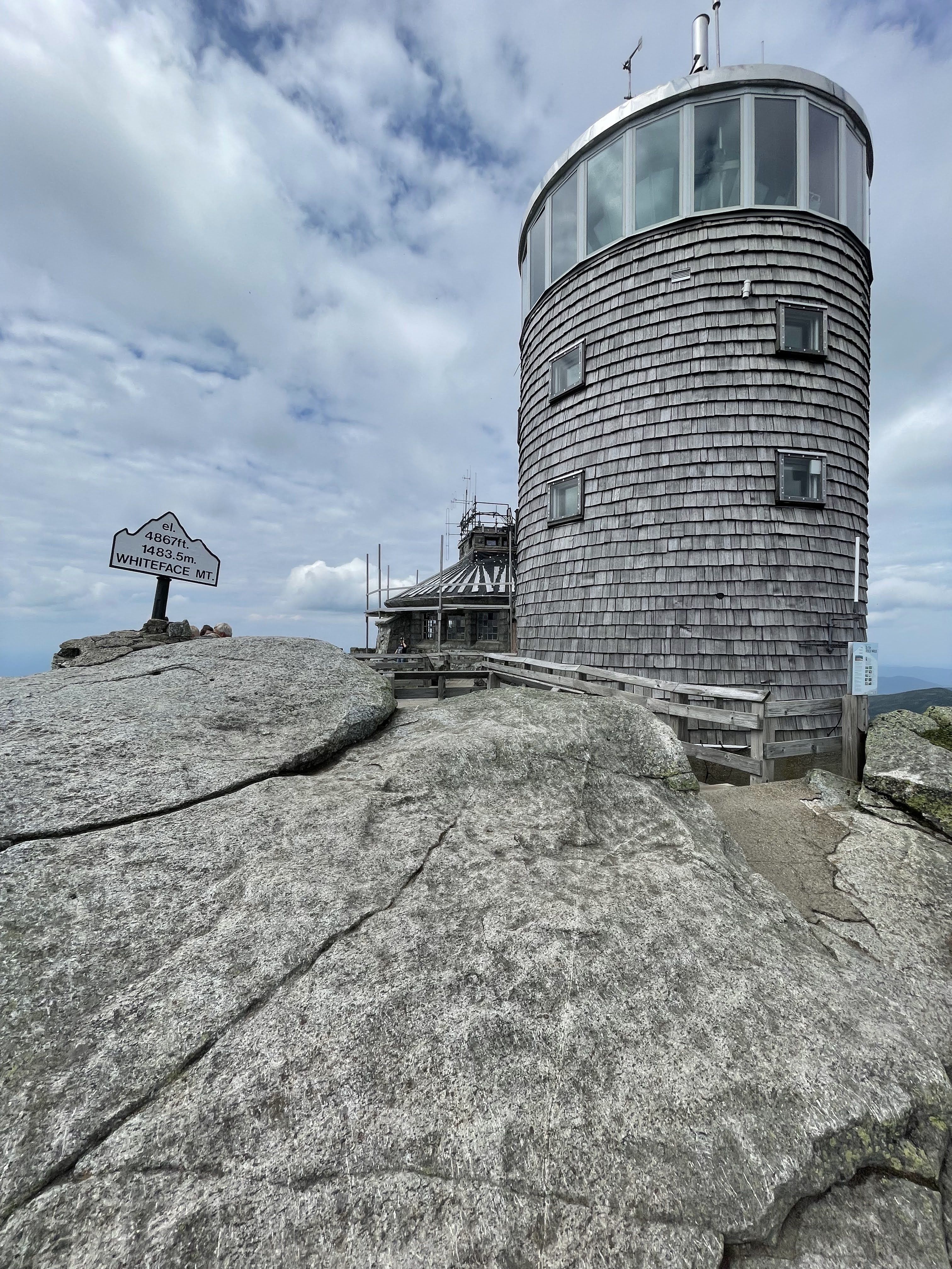
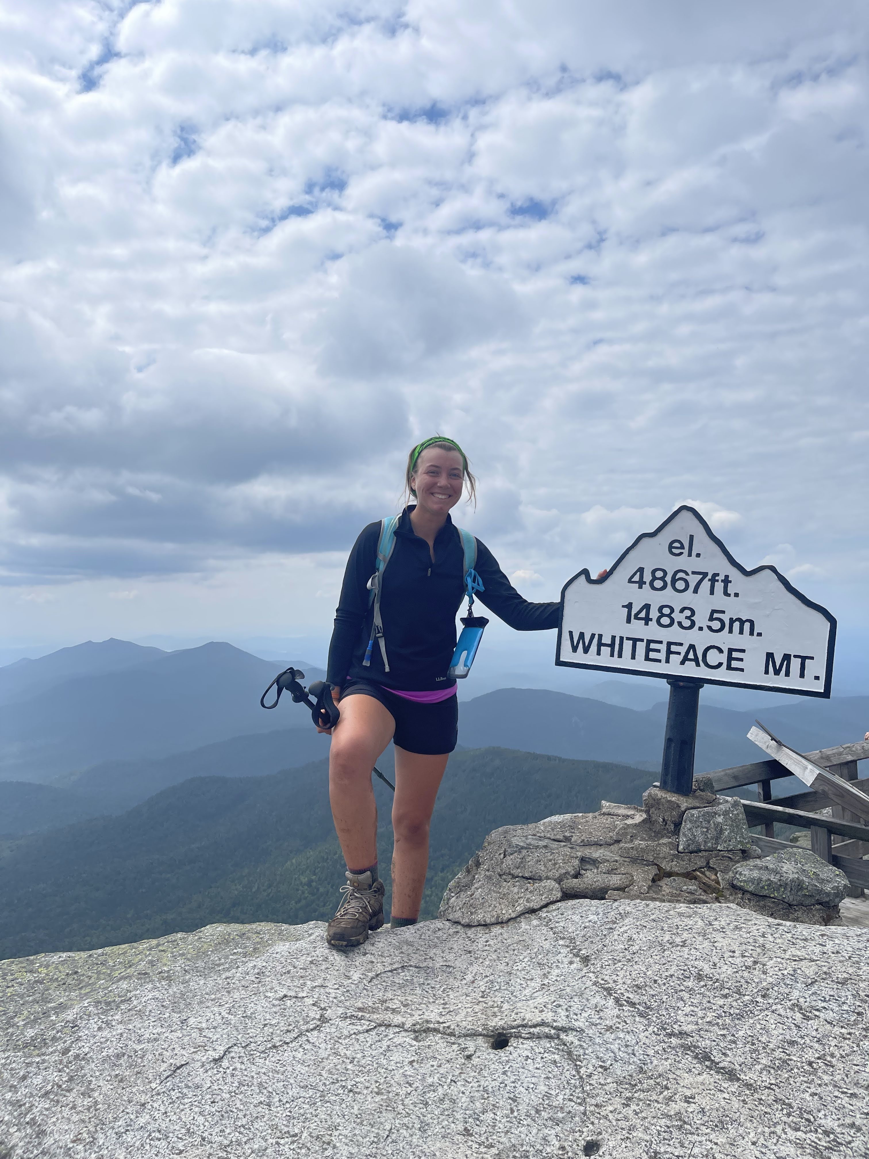
there is a paved road that goes close to the summit of Whiteface. near the summit the trail will take you to this road and then immediately back into the woods. do not make the mistake of just continuing to walk up the road because you will miss the last .5 mile of the trail and amazing views. near the summit you will be walking over bare rock and have spectacular views of the surrounding mountains since you are above treeline. i made it to the summit around 2 p.m.

the summit of Whiteface is bare and offers a 360 view of the area. but, because there is a road that people can drive to the top, it gets crowded quickly on a nice summer day. there is even a restaurant and weather station at the top. i couldn’t find a spot to sit alone and enjoy the view because there were so many people there who drove up. it can be real frustrating when you are eating your squished peanut butter and jelly sandwich, sweating, while people are walking around in flip flops. but hey, to each their own, at least it was easy to find someone to take my picture.
to get back to the parking lot just follow the same trails you took on the way up. from the summit of Whiteface you have about 4.5 miles to go till you are done. the descent is pretty steep and quick so just keep an eye on where you are walking to avoid falling on the steep terrain. i got back to my car at 4:30 and was probably the cleanest i have ever been after a hike in the High Peaks.
overall thoughts on the trail
this hike was rewarding for me for a couple of reasons. it only took me about 5.5 hours for a 10.5 mile hike, which to me, isn’t a bad pace.
on the way up there was a couple that stopped me and asked if they were on the right trail to Whiteface, and when i said yes they said “okay good, we figured we would ask you since you look like you know what you’re doing.” i was happy to hear them say that. most of the time i feel like i might not always know what i am doing. but at least i look like a hiker that knows whats up.
the hike was also kind of disappointing to me. i knew there was a road that you can drive up to get to the top of Whiteface, but i didn’t know this road was that popular. i couldn’t find a place to sit without someone stepping over me and my bag. there were people with t-shirts of Mount Everest taking pictures with professional cameras while wearing hiking boots that had no sign of wear and tear. it was discouraging to see that many people just drove to the top and neglected to take the beautiful trail to the summit. that being said, roads to the summits of mountains are also very valuable for people who may not have the ability to hike. so, while it is discouraging to be gasping for breath in front of a family in flip flops, it is also amazing that anybody can drive up there and appreciate the beauty in the High Peaks.
also, it is worth noting that if you are going for the 46er title, walking up or down the Whiteface road does not count toward your hike of summiting Whiteface.
what i brought
- 15L hiking pack
- Merrell Moab Mid-Ventilator Women’s hiking boots
- running shorts
- tank top
- trekking poles
- light jacket
- wool socks (x 2)
- sunglasses
- bandana
- first aid kit
- 32 oz nalgene with hydration mix
- 2L bladder bag of water
- food!
- peanut butter and jelly sandwich
- trail mix
- apple
- tortilla chips
- gatorade energy chews
- homemade hiker bars
- clif bar

Leave a comment